
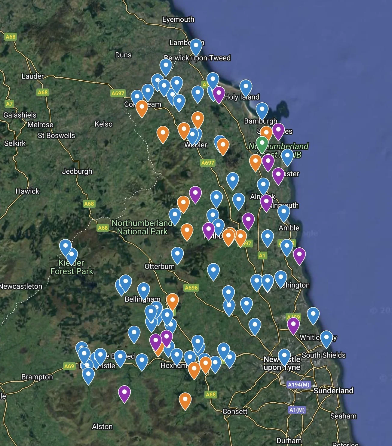
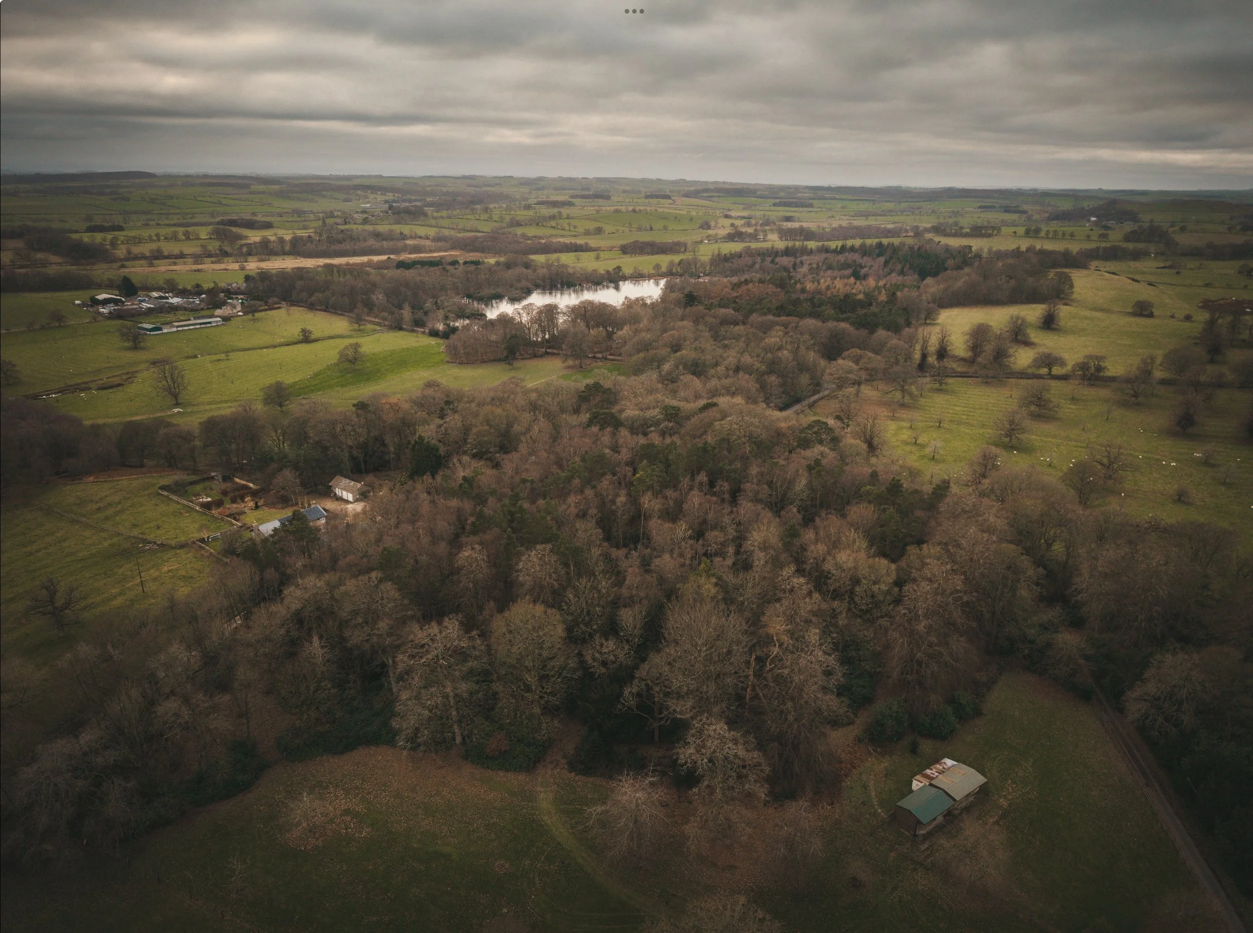
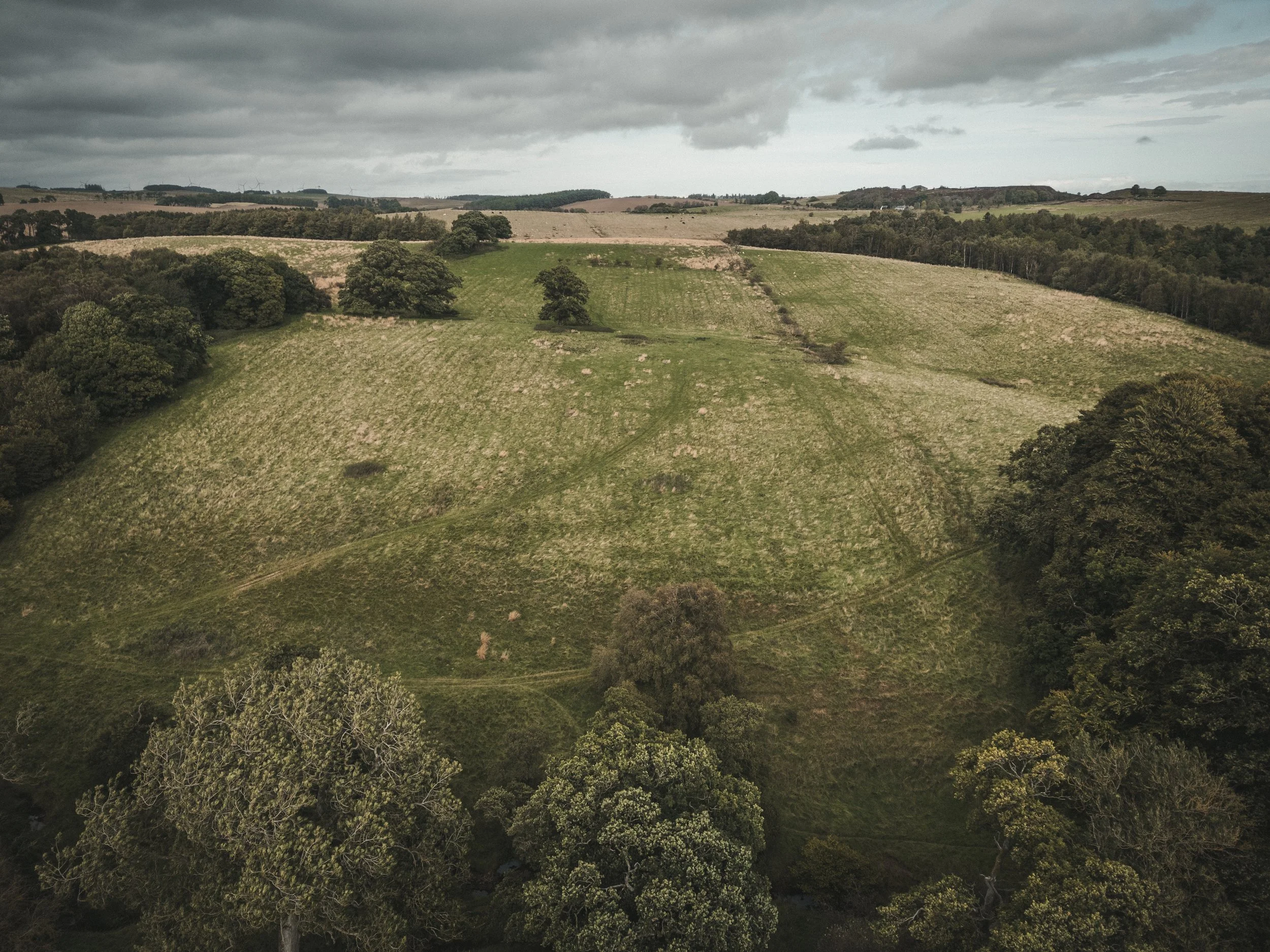
The Northumberlander Project is setting out to create the first ever photographic record of all of Northumberland’s castles.
There are over 70 castles in Northumberland, more than any other English county (If you add in Bastles and Peles, there are well over 100). And to the best of my knowledge, no one has ever catalogued them all in one collection of images, for people to enjoy and as a historic record.
Being the landing ground for Viking invaders and the borderland between Scotland and England, the county has seen a turbulent past with battles raging here for centuries. The remaining castles, some over 1400 years old, are legacies of this dramatic and bloody history. They range from small remote ruins, to grand fortress strongholds on top of volcanic hilltops and in lavish country estates, which are still inhabited today.
Steeped in legacy and intrigue, many of these have featured in blockbuster Hollywood movies like; Harry Potter, Transformers and Indiana Jones as well as TV shows like The Last Kingdom, Vikings, Downton Abbey and even Black Adder. Please feel free to share this page, and be sure to sign up for my newsletter to see the collection build over time.
I’m trying to complete the project as quickly as possible, so many of the images below are not photographically how I would want them to be. Many of castles have restricted access which limits my ability to compose an good shot... This combined with the unreliable Northumbrian weather means that some of the images below, are not as I’d intend them to look and I will return to those market with an * when light is better or access to the grounds is permitted. For now, they * castles are nothing more than a documentation of the castle.
Bear with me, this could take a while! 😂

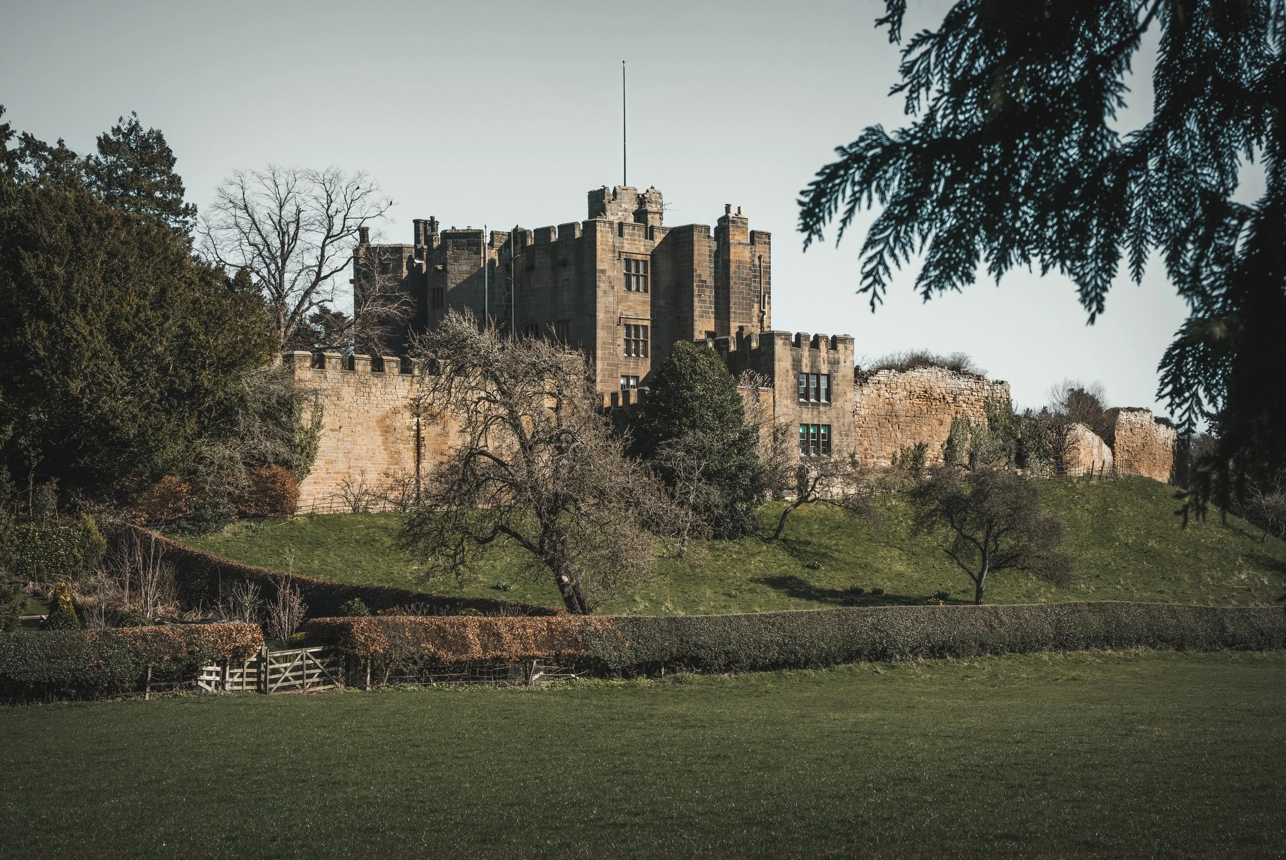
Alnwick
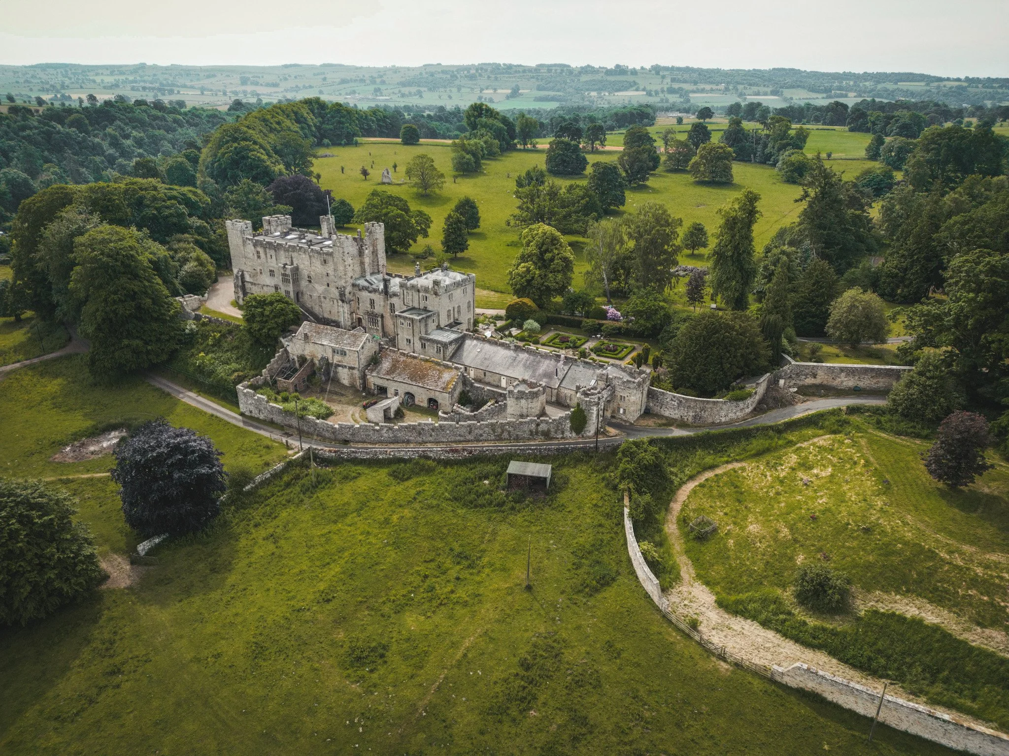
Alnwick Castle has almost 1000 years of history with its construction dating back to c.1096 by Ivo de Vesci. Since 1309, its story has been synonymous with that of the Percy family, a family with a history as illustrious as the castle self.
In its early life it faced frequent bombardment by the Scots, including its capture in 1136 by David I of Scotland. In 1215, Alnwick was ordered to be demolished by King John following accusations that Eustace de Vesci, Ivo’s great-grandson, was plotting against him – thankfully these were never carried out!
In the 14th century it was sold to the Percy family who undertook substantial building projects, transforming Alnwick into a major fortress along the Scottish border. From political clout and military achievement, to scandalous romance and gunpowder plotting, the Percys have long been powerful yet rebellious players in England’s history.
One of the most famous members of the family was Harry ‘Hotspur’ Percy, a fierce knight immortalised in Shakespeare’s play Henry IV. In 1403 he died in battle leading a rebellion against Henry IV, and his statue stands at Alnwick Castle today.
Other rebellious Percys include Thomas Percy, one of the infamous Gunpowder Plotters of 1605! In another charming tale of Percy lore, Henry Percy, 6th Earl of Northumberland once intended to marry Anne Boleyn, a union that evoked scandal and was duly separated before Boleyn infamously married Henry VIII.
Alnwick Castle itself saw much action over the years, including during the Wars of the Roses in which it was jostled between the Yorkists and Lancastrians many times before being returned to the Percys upon their sworn allegiance to Edward IV.
Today, it is the second largest inhabited castle in the UK. Alnwick castle has served as a military outpost, a teaching college, a refuge for evacuees, a film set for Hollywood movies like Harry Potter and Transformers as well as TV shows like Downton Abbey and BlackAdder… and perhaps most importantly, a family home.
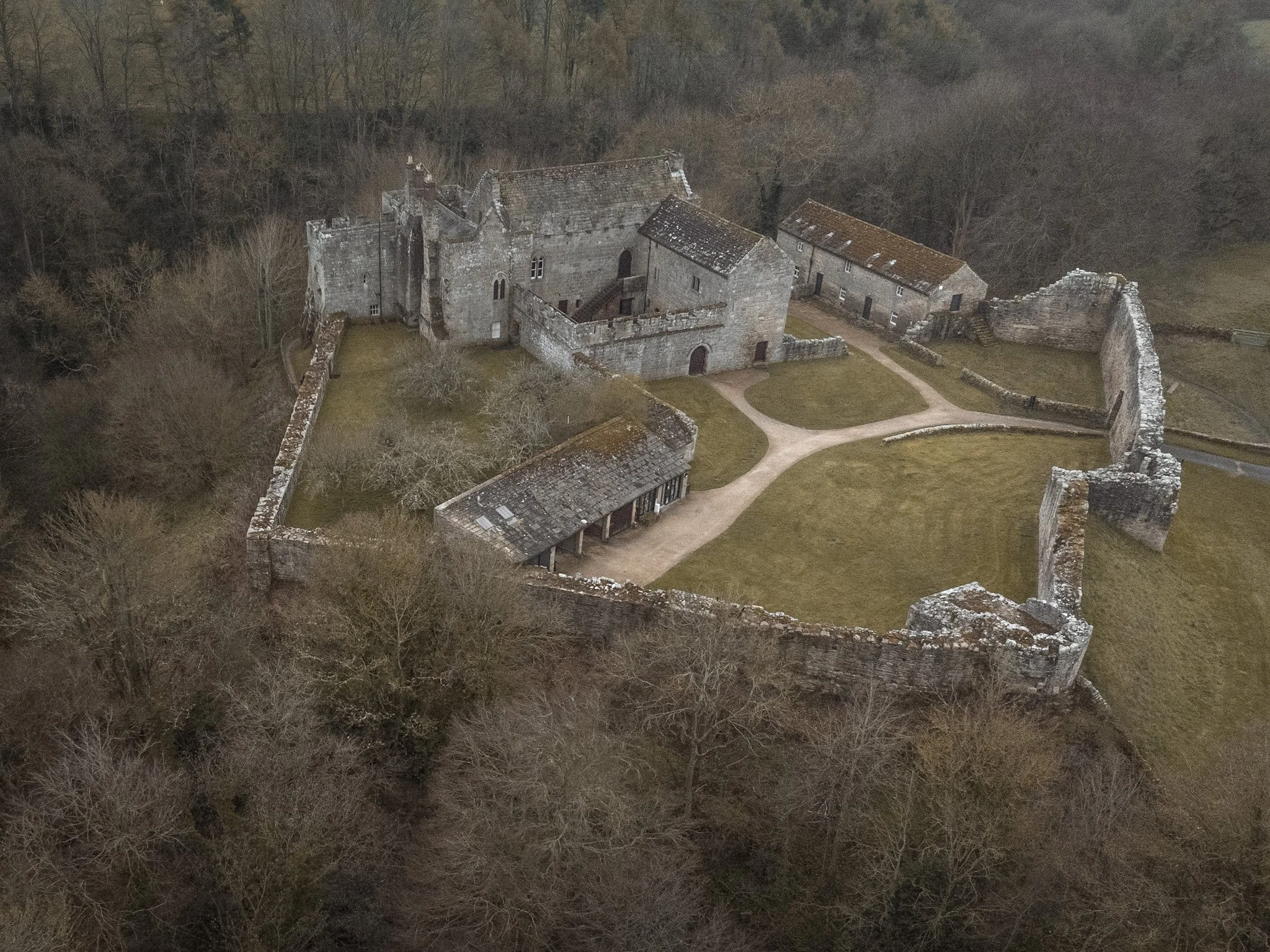
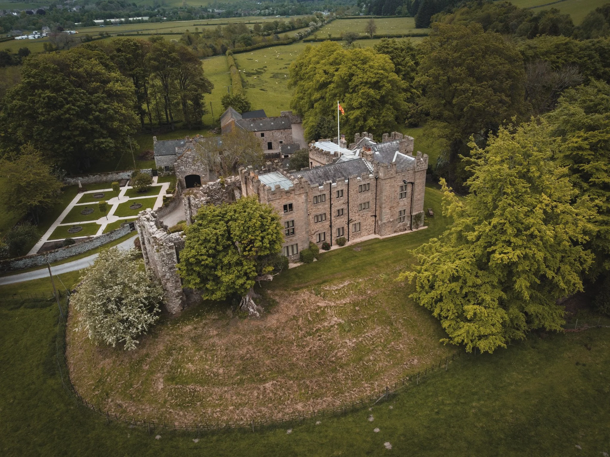
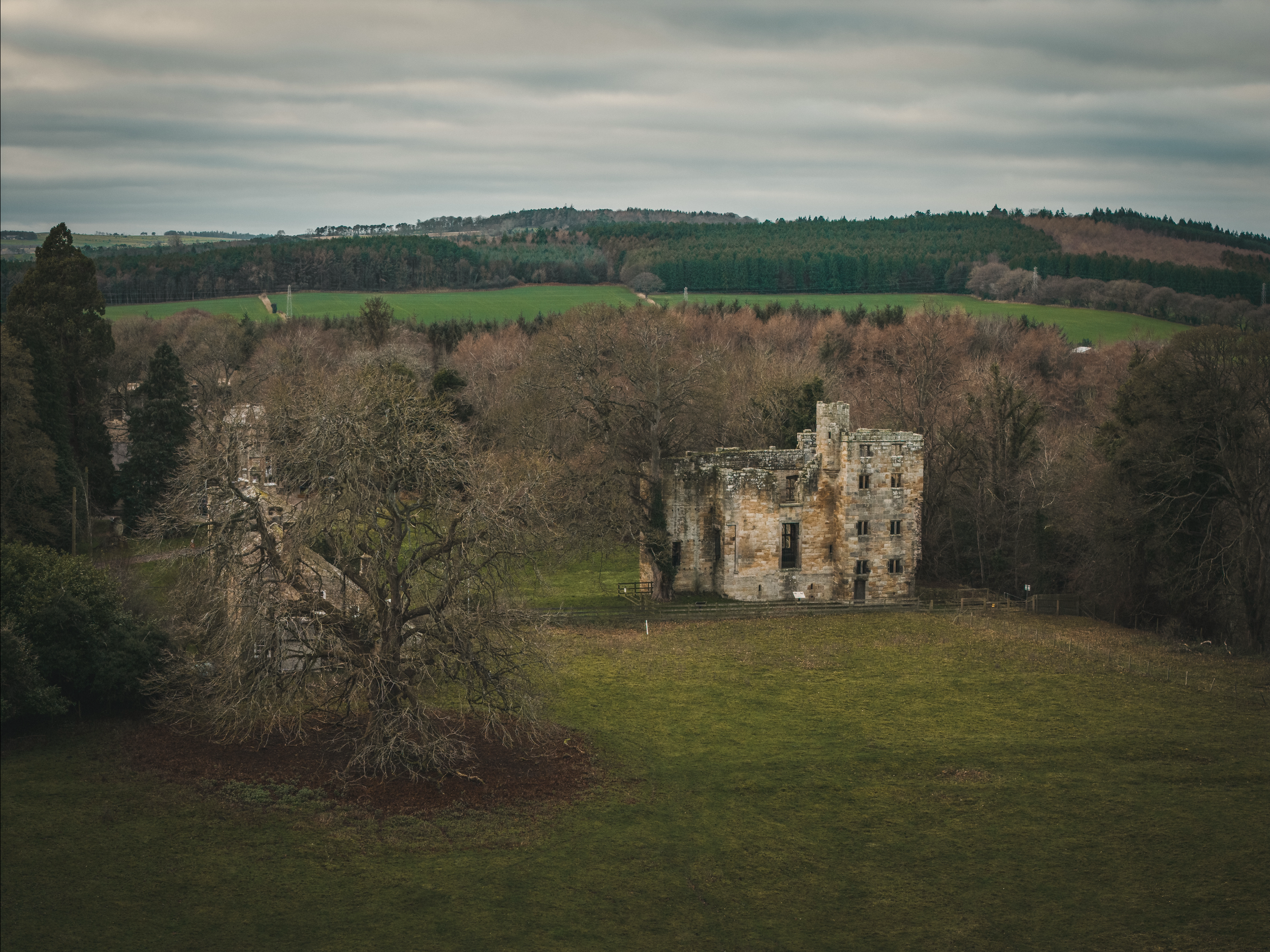
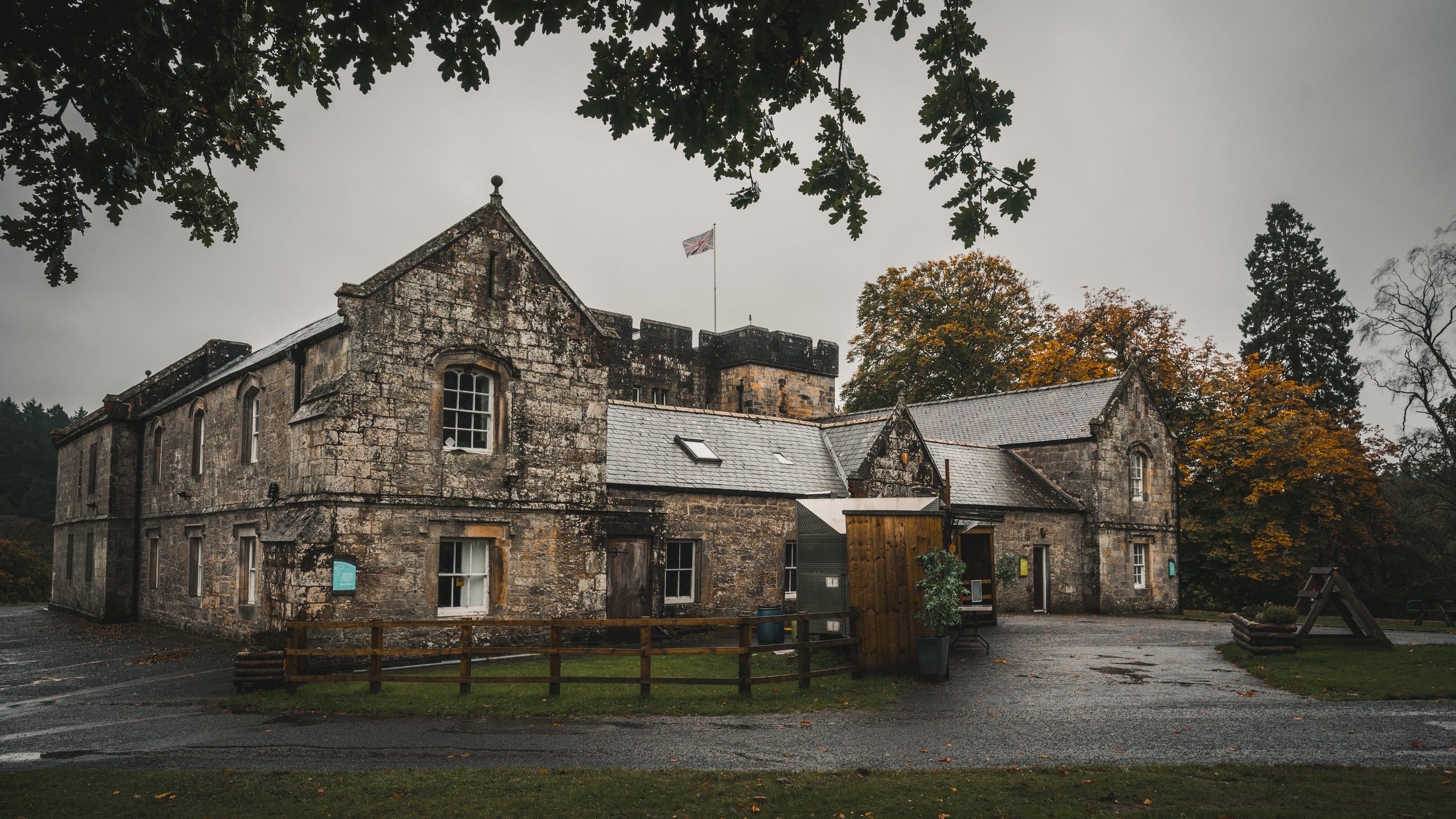
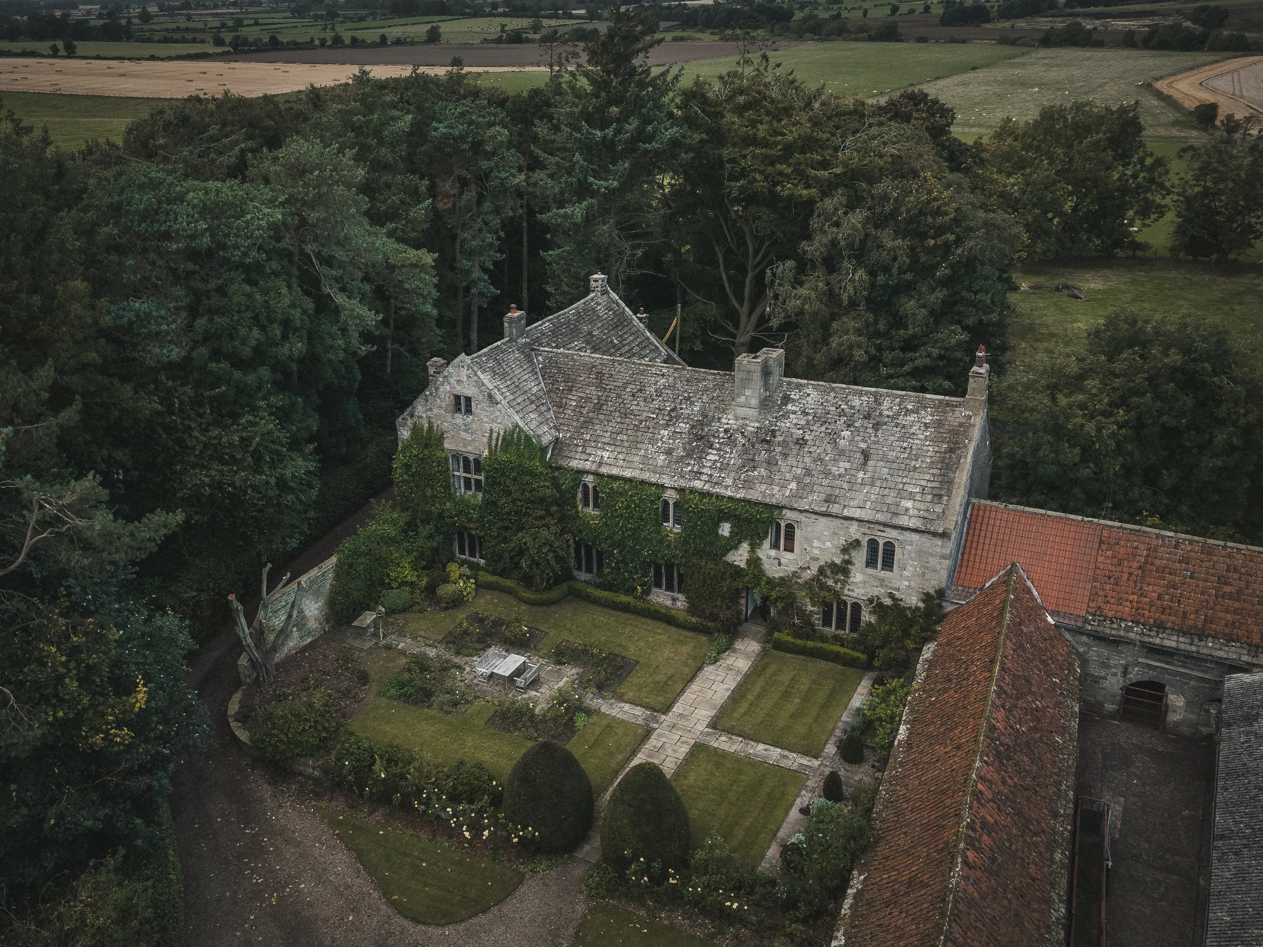
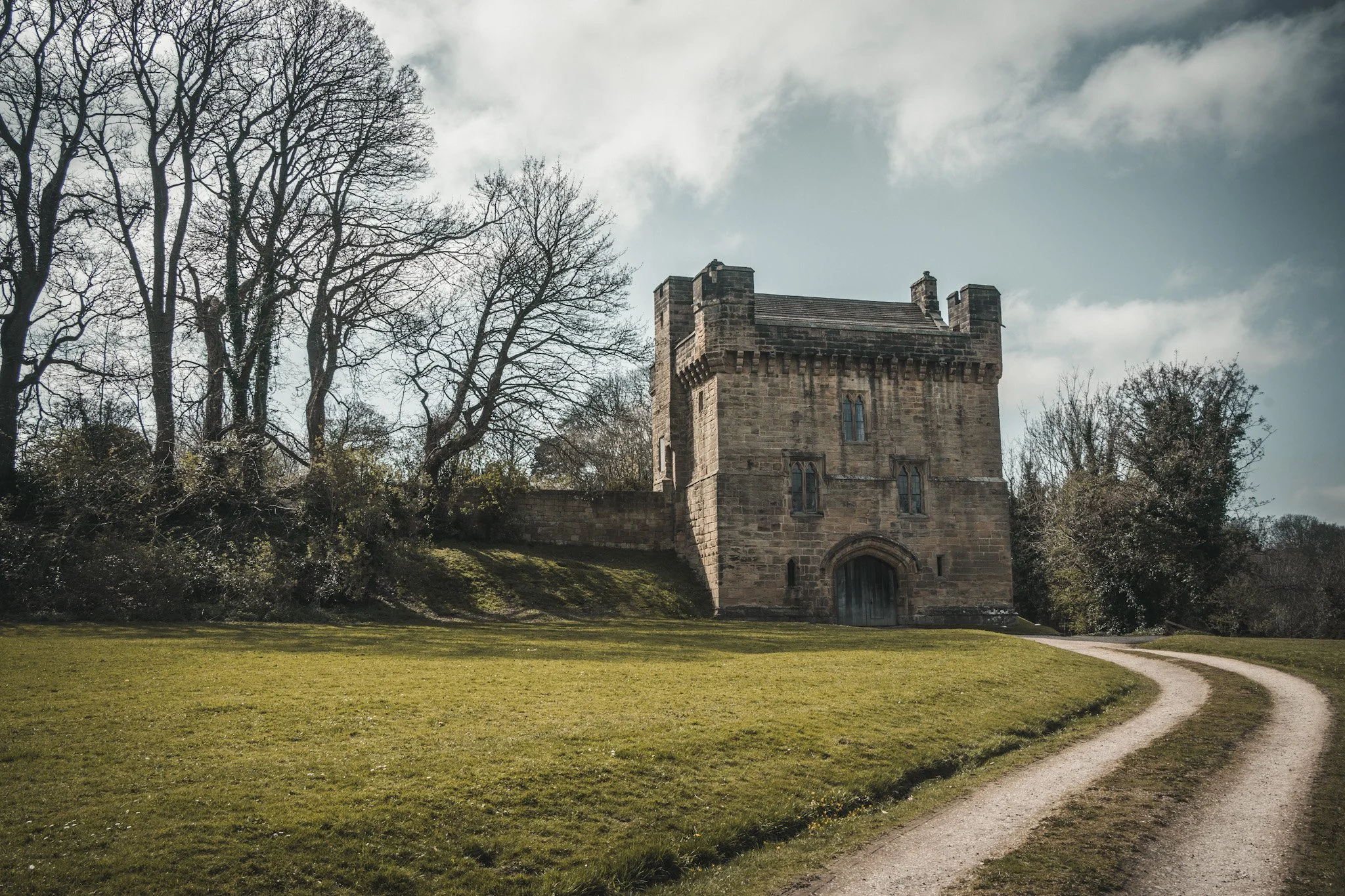
Aydon
Tucked away in a secluded valley a mile from the village of Corbridge, the original manor house began construction in 1296. At the time of its initial construction, the manor did not feature any defensive works or fortifications. Shortly after the stone construction began, Robert de Raymes added a two-storey hall range… Initially there was little need for fortifications to exist in Aydon.
However, this changed in 1305 when Aydon Hall received permission to add crenellations. It is possible that the crenellations were added only to increase the status of the hall, but it would soon prove necessary to fortify the hall beginning in 1311 and 1312, as Scottish border reivers began to launch raids into English territory.
Aydon itself was attacked during this time, successfully repelling at least two known assaults by Scottish forces. These Scottish raiders managed to damage the surrounding area, but were unable to capture Aydon Hall itself.
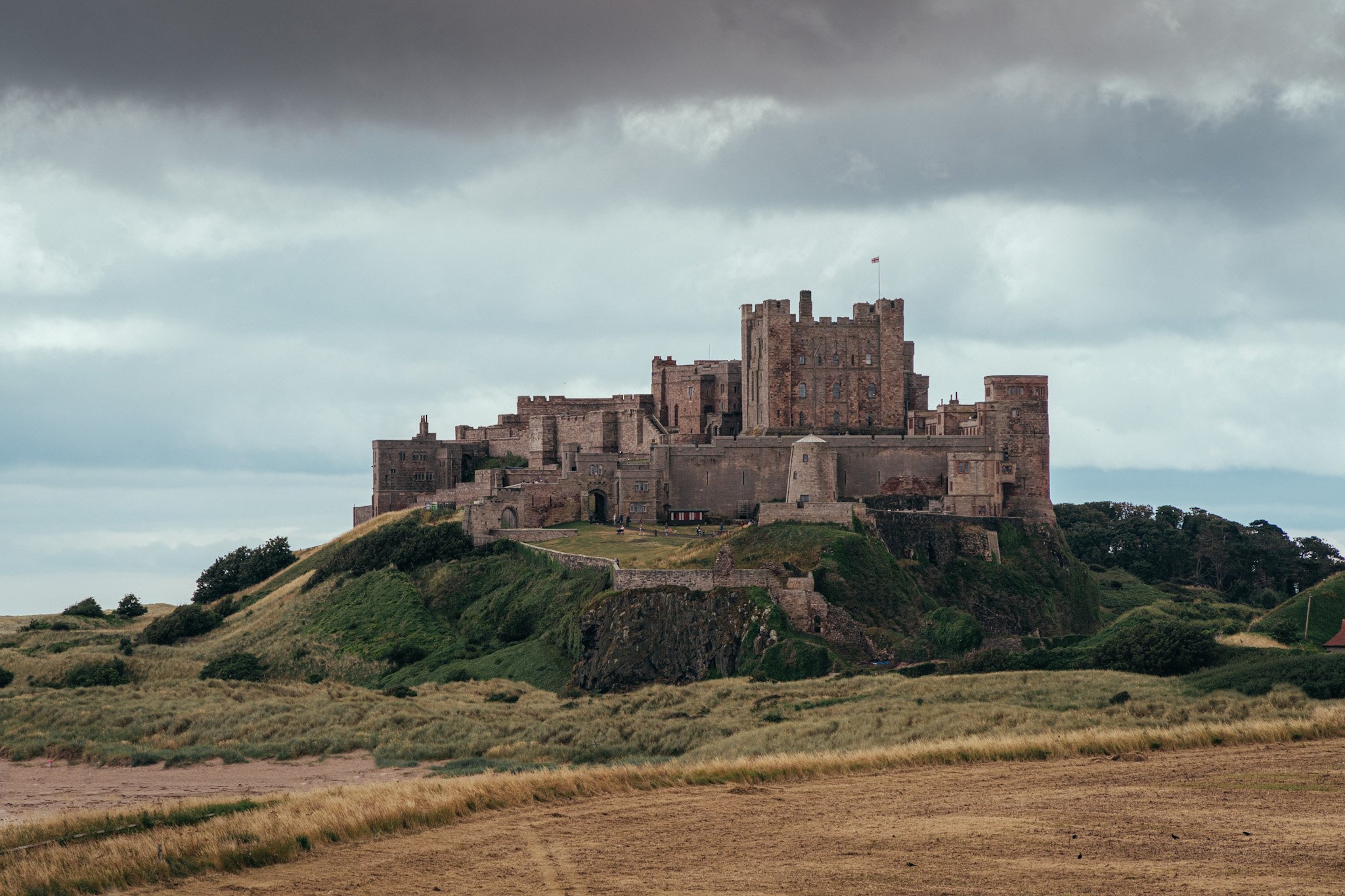
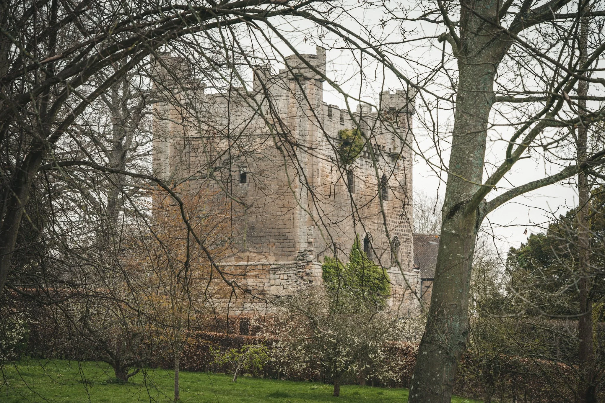
Bamburgh
Once known as Bebbanburg and arguably the counties most imposing stronghold, Bamburgh castle was built on top of a black crag of volcanic dolerite, and part of the Whin Sill. The location was previously home to a fort of the indigenous Celtic Britons known as Din Guarie. This site and fortress was the capital of the kingdom of Bernicia and Northumbria from its foundation in c. 420 to 547.
It was then captured by King Ida of Bernicia. After passing between the Britons and the Anglo-Saxons three times, the fort came under Anglo-Saxon control in 590. In that year the citadel was captured by the Anglo-Saxon ruler Ida of Bernicia (Beornice) and became Ida's seat.
The castle was briefly retaken by the Britons from his son Hussa during the war of 590 before being retaken later the same year. In c.600, Hussa's successor Æthelfrith passed it on to his wife Bebba, from whom the early name Bebbanburg was derived. Vikings destroyed the original fortification in 993 and the Normans later built a new castle on the site, which forms the core of the present one. After a revolt in 1095 supported by the castle's owner, it became the property of the English monarch.
The castle is owned today by the Armstrong family and is the UK’s largest inhabited castle.
Barmoor
Barmoor Castle was the medieval home of the Muschampe family. In 1341, Thomas Muschamp obtained a licence to build a crenelated tower, but it failed to keep out raiders in 1367. In
1514, it was serviceable and capable of lodging 30 horsemen, but by 1541 was ruinous. In 1801 a mansion grew around the tower, but by the 1980s this was ruinous.
Today this is the main building in a luxury privately owned holiday home park.

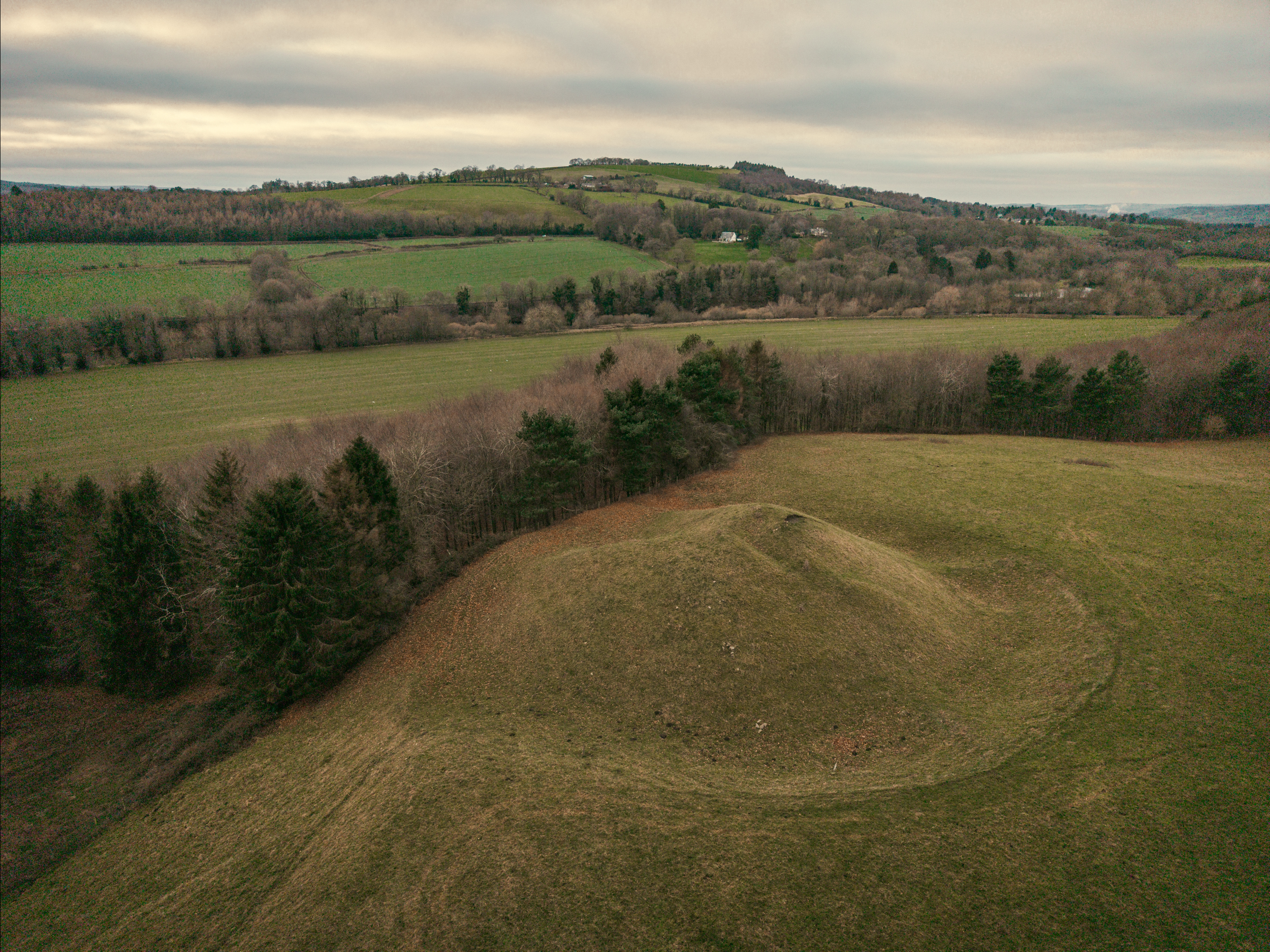
Bellingham
Bellingham Castle was probably an early 12th century Motte and Bailey castle, built by the Bellingham family.
All traces of the stone castle had disappeared by the late 13th century, leaving only the mound which remains today. The existence of a castle here is suggested by documentary evidence which reports that William de Bellingham, sheriff of Tynedale and Forester of Tynedale under the king of Scotland, had his seat at Bellingham.
The mound, near the Harelaw burn and close to the mill from which, in 1263 a huge rent of 10 pounds was paid yearly, is topped by a smaller mound.
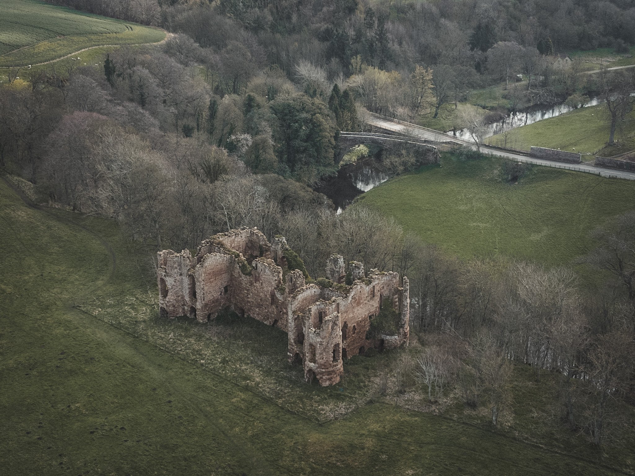
Bellister
Bellister Castle stands on a prominent mound rising from the floodplain of the South Tyne, 1km south west of Haltwhistle. The mound or motte on which it stands - apparently partly natural and partly artificial - suggests an origin in the late 11th or 12th century, whilst the present ruined building is a first floor hall house of late 13th or early 14th century type enlarged by the addition of a three storeyed solar tower at its north west end.
The remains of the castle never appear to have been examined or recorded in any detail. The earlier part of the building appears to have been an elongate hall block aligned north east to south west along the top of the mound and was defended by a moat which is traceable on all but the south east side.
The early history of the castle has not been well researched.
Belsay
Belsay Castle, located near the village of Belsay, can be traced back to the early 14th century when it was built as a medieval stronghold.
One of the most intriguing aspects of Belsay Castle is its unique design. Its imposing façade, punctuated by soaring towers and strong stone walls, transports visitors to a time when castles were built to command respect and evoke awe.
Build in 1370 as a Pele Tower and was home to the Middleton family and in 1614, Thomas Middleton built a new manor house attached to the tower.
Berwick
Northumberland’s northern most stronghold, the castle was commissioned by the Scottish King David I in the 1120s. It was taken by the English forces under the terms of the Treaty of Falaise in 1175 but then sold back to Scotland by the English King Richard I to fund the Third Crusade in around 1190.
In November 1292, representatives of the English King Edward I arrived in Berwick and announced, in the great hall of the castle, King Edward's adjudication in favour of John Balliol of the dispute between him, Robert the Bruce and the count of Holland for the Crown of Scotland. The castle was retaken by the forces of King Edward I in March 1296 during the Frist War of Scottish Independence. However, the forces of Robert the Bruce recovered the castle for Scotland in April 1318.
The castle was rendered less useful or necessary in the late 16th century during the reign of Queen Elizabeth I as more modern ramparts were build around the township and the castle fell in to decline and ultimately ruin.
Blenkinsopp
The castle incorporates fragments of a medieval tower house and was licenced to crenellate 1340. The earliest mention of the castle is found in this licence to crenellate issued by Edward III on 6th May 1340, to Thomas de Blenkensop; the 1415 list appends the marginal note 'fortalicum' to the entry 'Castrum de Blekensope', whilst the 1541 survey states the tower as in decay.
The original form of the castle, a massive tower with vaulted basements was closely enclosed by a tall curtain wall - This was not easy to replicate, although Pendragon Castle (Westmorland) had a similar footprint.
Blenkinsopp would appear to have been a small but sophisticated castle rather than a simple tower house; it may well have been a 14th century building
Bolam Castle
Bolam Castle is the name given to an Iron Age hillfort constructed on a locally prominent hill to the west of, and in the grounds of, Bolam Hall. Another fort lies only half a mile to the west, but at the named site, antiquarians noted the presence of a square building surviving as foundations into the 1920s, but there are no such remains today, and the whole fort is heavily overgrown with trees.
In 1305 the settlement had been important enough for it to be granted a market and fair, but the war with the Scots entered a new phase in 1306 when Robert Bruce claimed the throne, and in 1316 de Reymes complained that his Northumberland lands, which had once been worth £50 per year, were no longer bringing in any income, and in 1323, Bolam was described as being the site of a manor that had been destroyed by the Scots and worth nothing.
Subsequently, the place seems to have remained in ruins, and was never repaired. There is no public access to the site, which is within private grounds, and due to the trees, it cannot be seen from the adjacent public road.
Bothal
Botl is old English for a dwelling. Bothal could refer to a particular dwelling or hall. It was fortified before the Norman conquest, and renovated and remodelled a number of times. It is a Scheduled Ancient Monument and a Grade I listed building.
In 1095, Bothal was given by King William Rufus to Guy I de Balliol, whose daughter Alice married William Bertram, Baron of Mitford, who probably built a hall house. Several generations later, in 1343, Sir Robert Bertram was given permission to turn his manor house into a castle, including an impressive gatehouse. The gate tower and fragments of curtain wall are medieval, a good deal of which still survive to this day.
Restoration was carried out in the 19th century. The building is used as a private residence of the Cavendish-Bentinck family and also houses the Welbeck Estate Office. The castle is in an excellent state of repair and is not accessible for the public.
Bywell*
An 11th-century Norman castle probably built by Guy de Balliol around 1090. The castle stands on the north bank of the River Tyne. The original Norman fortification was later restored and strengthened in the 14th and 15th centuries by the Neville family, with the addition of a curtain wall and gatehouse.
King Henry VI fled to Bywell Castle after his defeat at the Battle of Hexham in 1464. His enemies were close on his heels, however, and when Lord Montague arrived at Bywell he found the king's crown, helmet, and sword, but Henry was nowhere to be found.
The crenellated tower and curtain wall were later built into a 19th-century house. The castle is private property, and not usually open to visitors, but it can be viewed easily from the roadside and the nearby churchyard.
The castle is now privately owned and not open to the public.

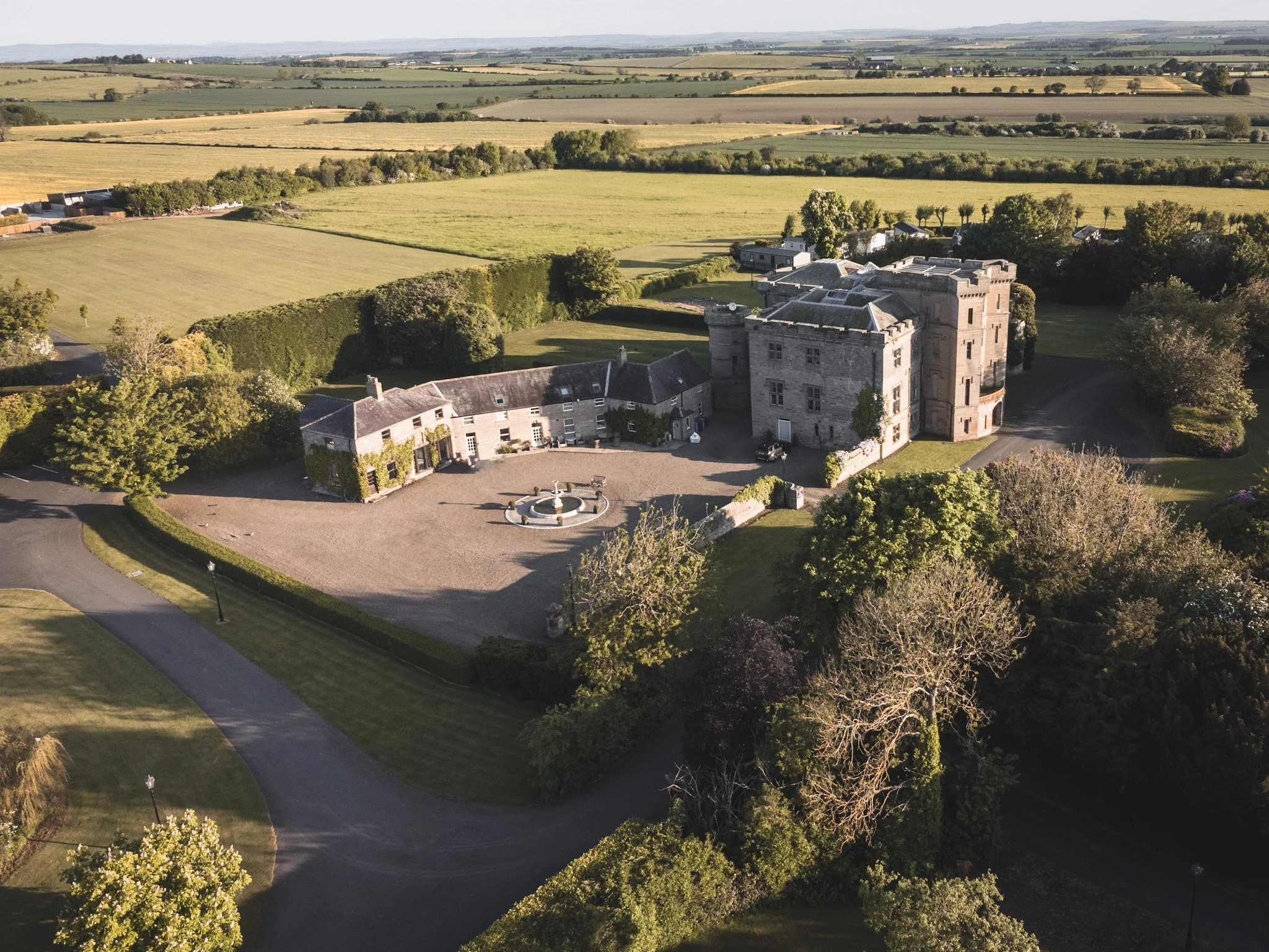
Callaly
Callaly Castle is a Grade I listed building and substantial country house north of the village of Callaly. The site is around 9.0 miles to the west of Alnwick.
The current castle is located near the site of a 12th-century motte castle as well as an Iron Age hill fort. A Pele Tower was built in the 14th or 15th century and this was subsequently incorporated, as the west wing, of a new house built by John Clavering in 1619.
The first major additions were made in 1676 and in 1707 further alterations were made which more or less concealed all the earlier features. Today the property is made up of a number of private residences and is not accessible to the public without permission.
Cartington
Cartington Castle is a ruin, and partly restored medieval castle in the hamlet of Cartington, some 2 miles north-west of Rothbury.
The castle looks down on the River Coquet and is a Scheduled Ancient Monument. Its first recorded owner was Ralph Fitzmain who held it in 1154. In the late 14th century a Pele Tower was also built. This was subsequently extended to include a great hall, and probably a tower-defended courtyard, by John Cartington in 1442 when he was granted a licence to crenellate his home.
The castle is situated on private farmland and is not accessible by the public. The above image was taken with access granted by the kind permission of the owner.
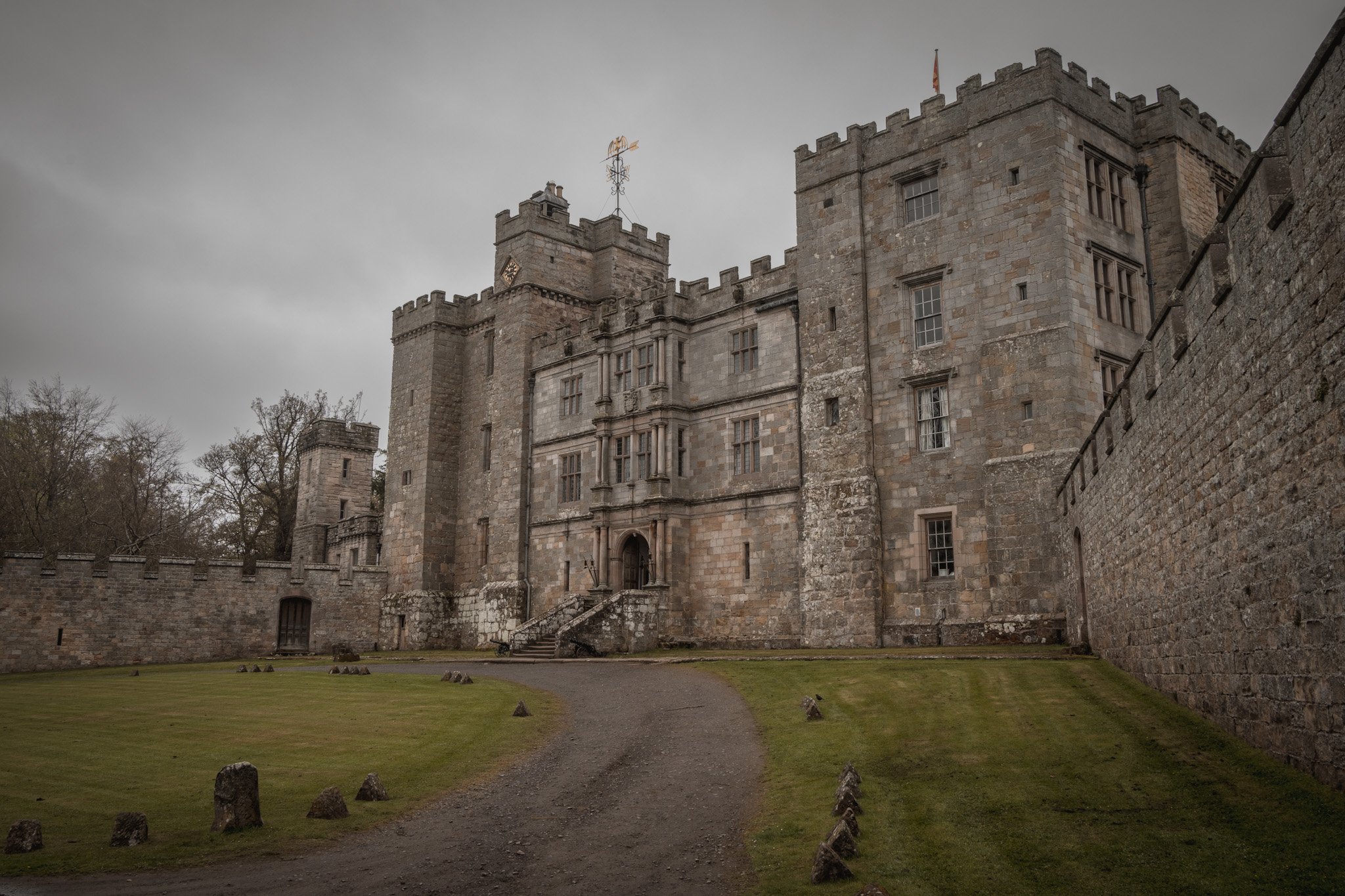
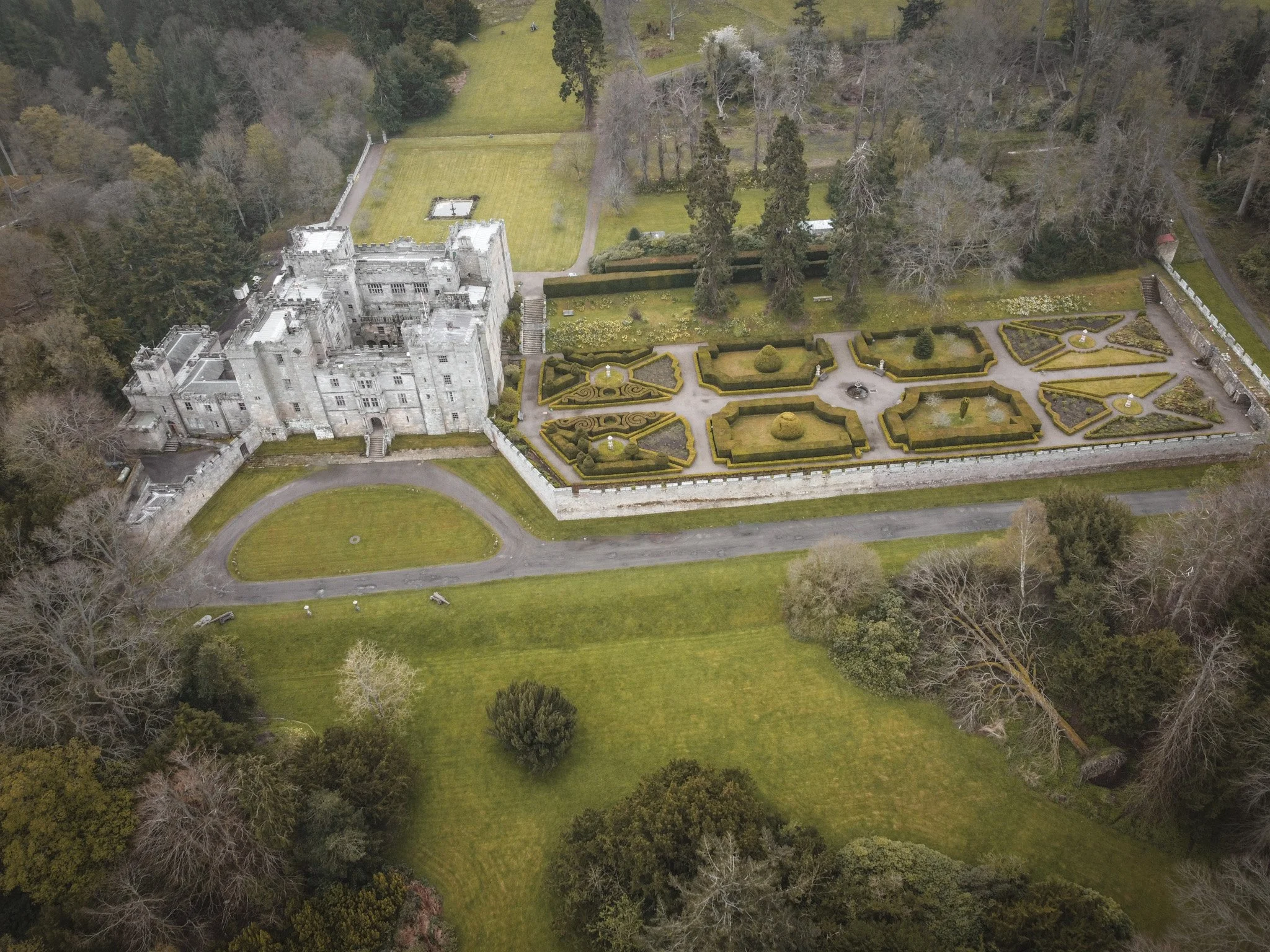
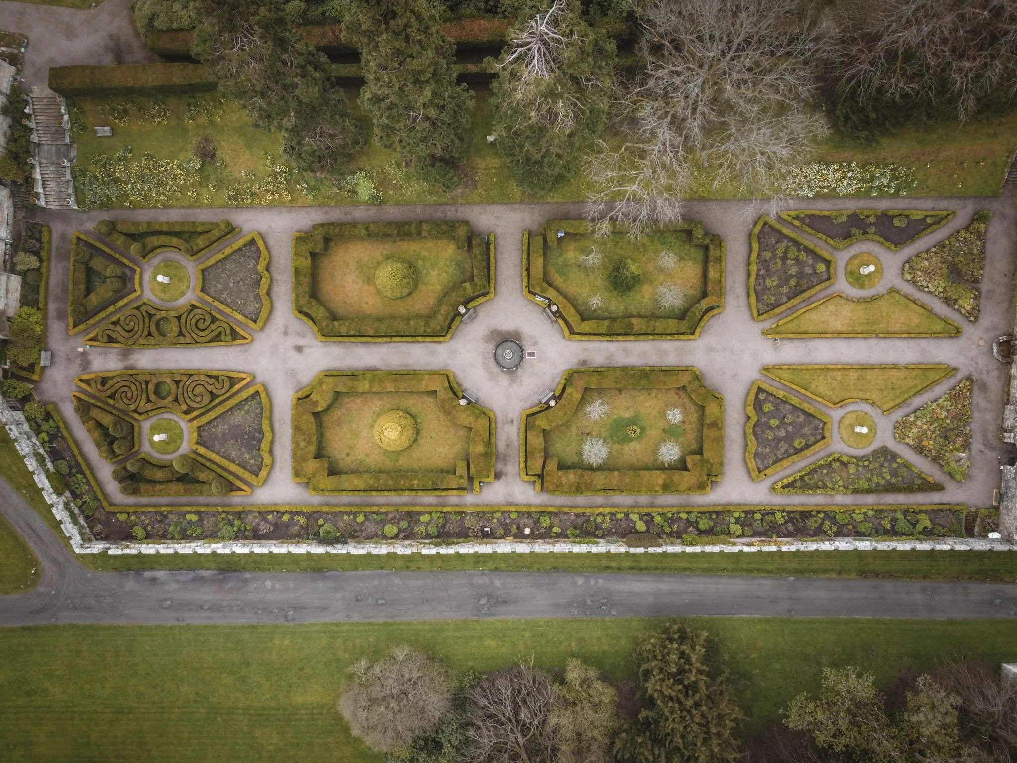
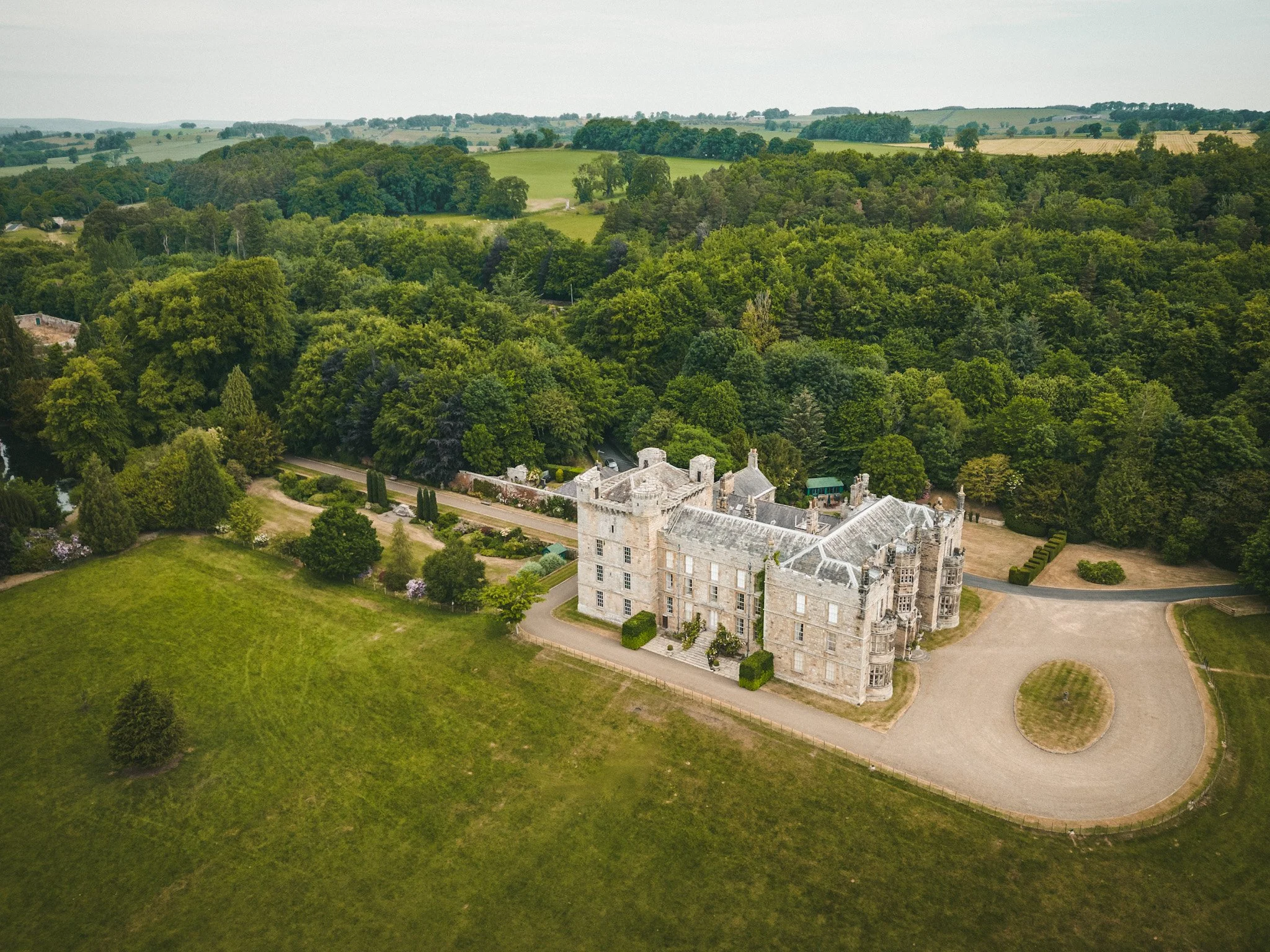
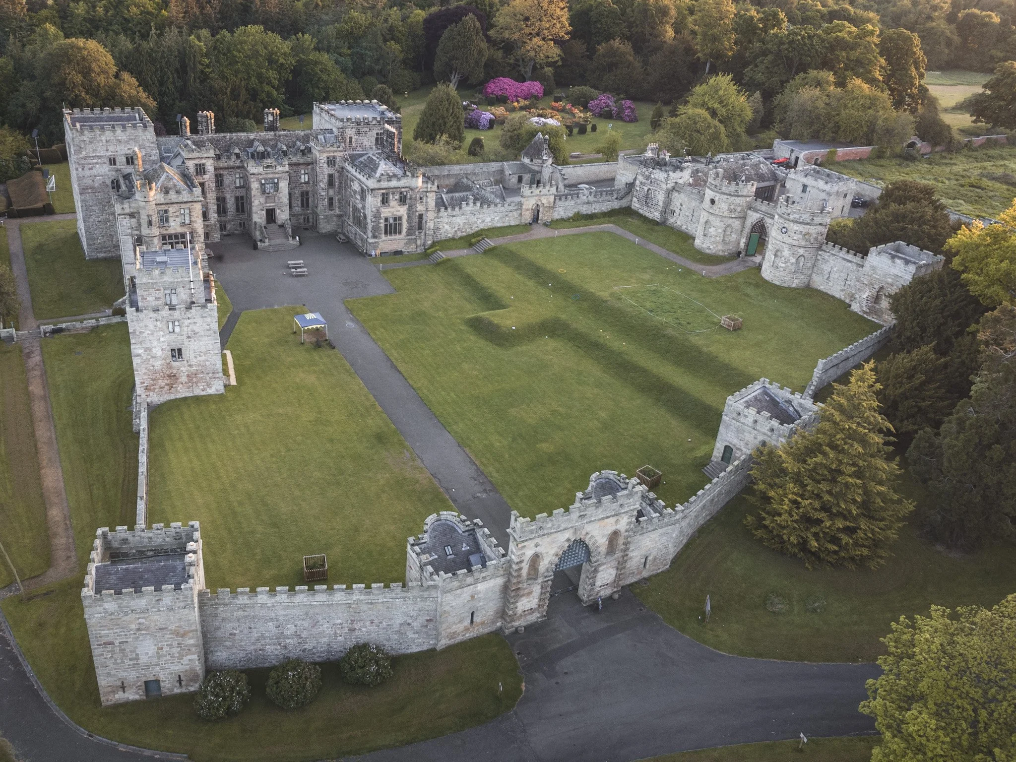
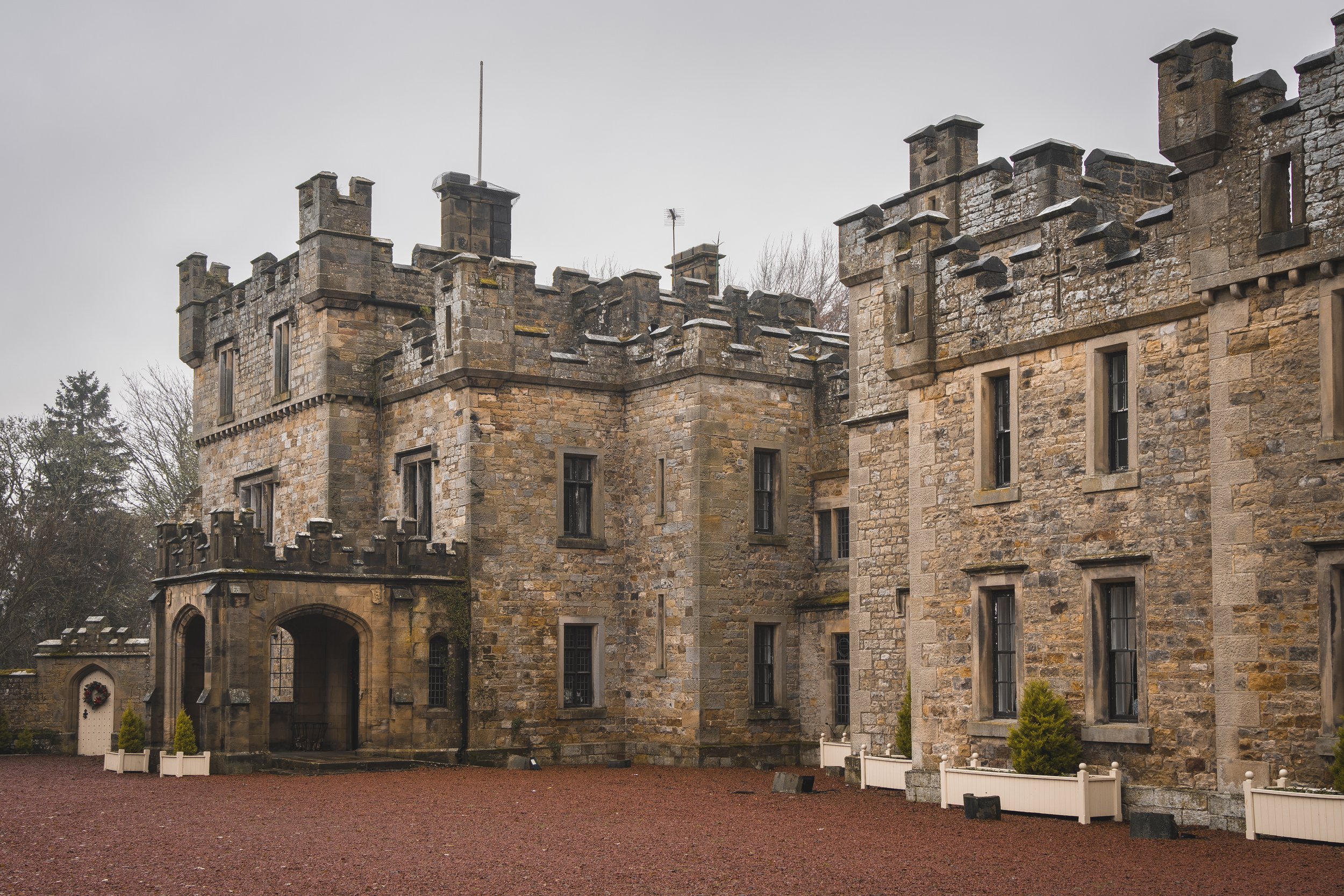
Chillingham Castle
Chillingham is a medieval castle in the northern part of Northumberland and dates back to the early 1200s. It was the seat of the Grey and Bennett (later Earls of Tankerville) families from the 15th century until the 1980s. In 1298, King Edward I stayed at the castle on his way to Scotland to battle a Scottish army led by William Wallace.
The castle occupied a strategically important location in medieval times: it was located on the border between two feuding nations. It was used as a staging post for English armies entering Scotland, but was also repeatedly attacked and besieged by Scottish armies and raiding parties heading south. The site contained a moat, and in some locations the fortifications were 12 feet (3.7 metres) thick.
The castle is reputedly the most haunted castle in Britain. It is also home to the Chillingham Wild Cattle, the only heard of this breed in the world. With just 130 heads, this makes them more rare than the Giant Panda.
ChipchasE
Nestled amidst the picturesque landscapes of mid-Northumberland, this historic castle, whose origins can be traced back over 700 years, has witnessed centuries of captivating tales and has become a cherished landmark in the region.
Originally built as a bastle house—a fortified farmhouse it gradually evolved through generations into the impressive structure it is today. It was owned by the Heron family for several generations.
However, throughout the years, Chipchase Castle has seen its fair share of sieges and battles, experiencing numerous changes of ownership. Renowned for its resilient architecture and striking appearance, the castle underwent substantial expansion during the 17th and 19th centuries, evolving into a grand country house.
Today, the castle serves as a testament to the fascinating history of Northumberland, welcoming visitors to explore its impressive grounds and unravel its captivating past.

Coanwood hill
A natural mound, which has been converted for defensive purposes possibly in medieval times. A steep slope naturally protects three sides of the mound, while one side has had an enormous ditch constructed to protect it. Much of the site has been damaged by the construction of a railway.
There are no traces of an entrance or causeway across the ditch. The feature is probably a Motte of the Scottish ridge or promontory type

Dally
Dally Castle is believed to have been erected by David Linsey in his manor of Chirdon, referred to in a document of 1237 as the 'house with remarkably thick walls in the form of a tower'
In the same year, Henry de Bolebec, Sheriff of Northumberland, complained to Henry III of England that de Lindsay was erecting a thickly walled tower that he intended to embattle. The construction subsequently stopped.
In 1255 there was no mention of a Castle. This castle was confiscated and handed to John de Swinburne, then to the Crown in 1326, by which time it had been raided by marauding Scots. The Castle is not mentioned in the 1215 or the 1451 lists. In the early 17th century it was occupied by the Dodds family.
On Speed's map of 1611 it is called Dala and earlier in his Britannia Camden called it Delaley.
Dilston
The three-storey tower was built by Sir William Claxton on the site of an earlier pele tower in the 15th century.
Duddo
In the North of the county high on a hill, stands Duddo Tower. It survives in reasonable condition as a ruined building and earthwork.
The full extent of the building and subsidiary structures survive as earthworks and will retain significant archaeological deposits. It is one of a wider group of medieval border towers reflecting the unstable warlike conditions in the region at this time. The monument includes the ruins of a medieval tower house, which is Listed Grade II, situated in a commanding position on top of crags immediately south of Duddo village.
The first known documentary reference to a tower at Duddo was when it was destroyed by James IV of Scotland in 1496. A part of this tower remained standing in 1541 and was described with a barmkin around it in 1561.
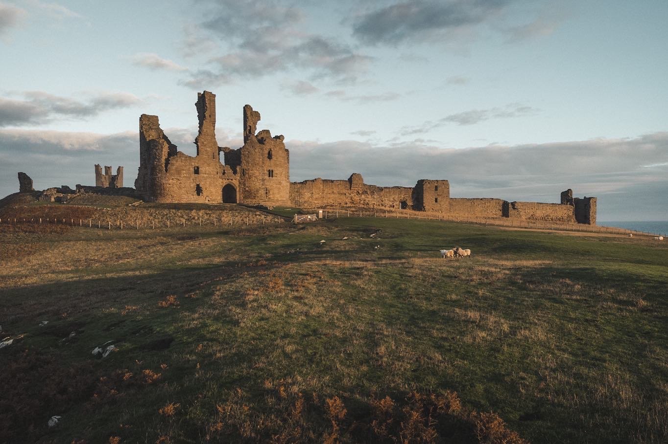
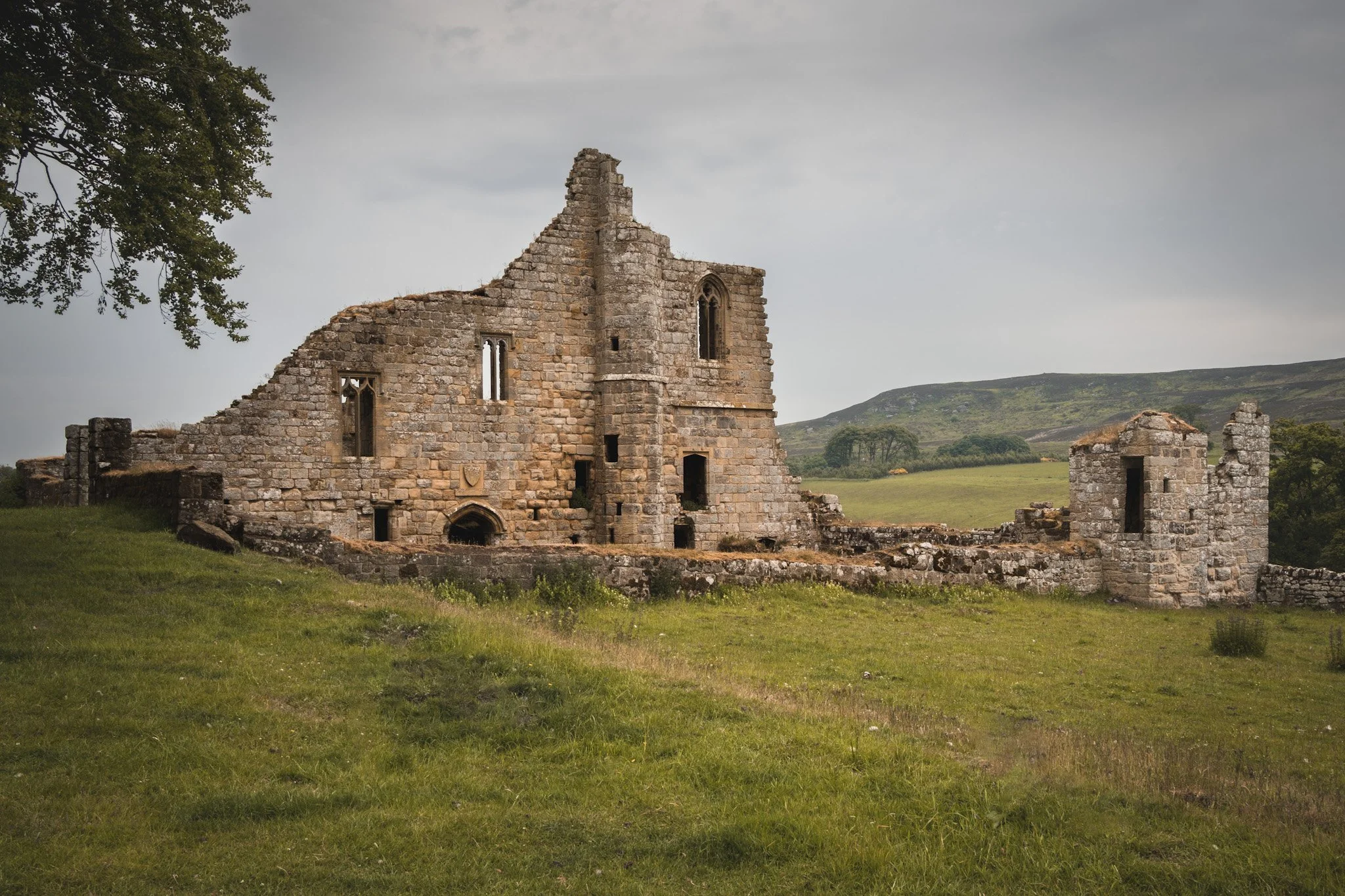
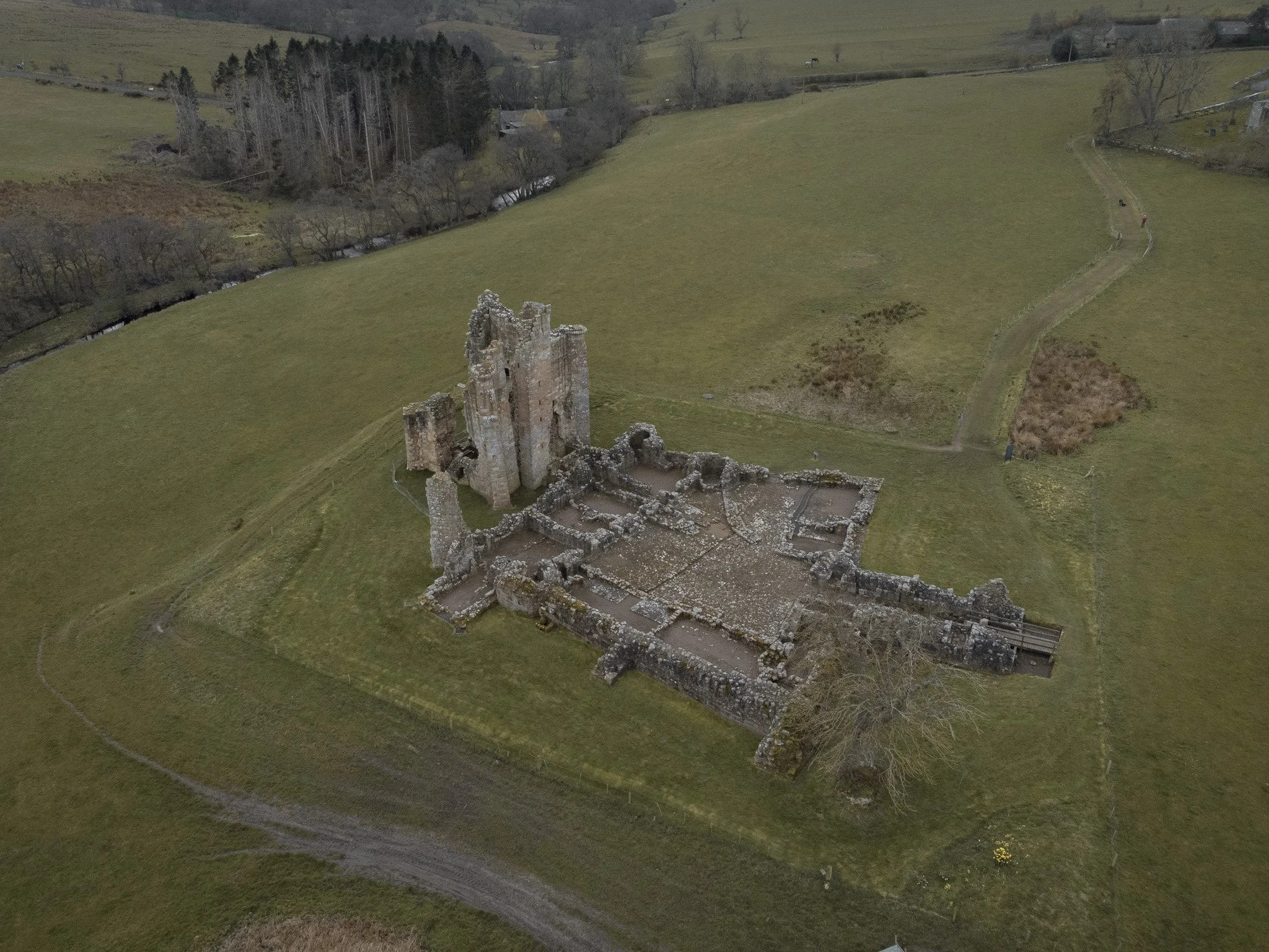
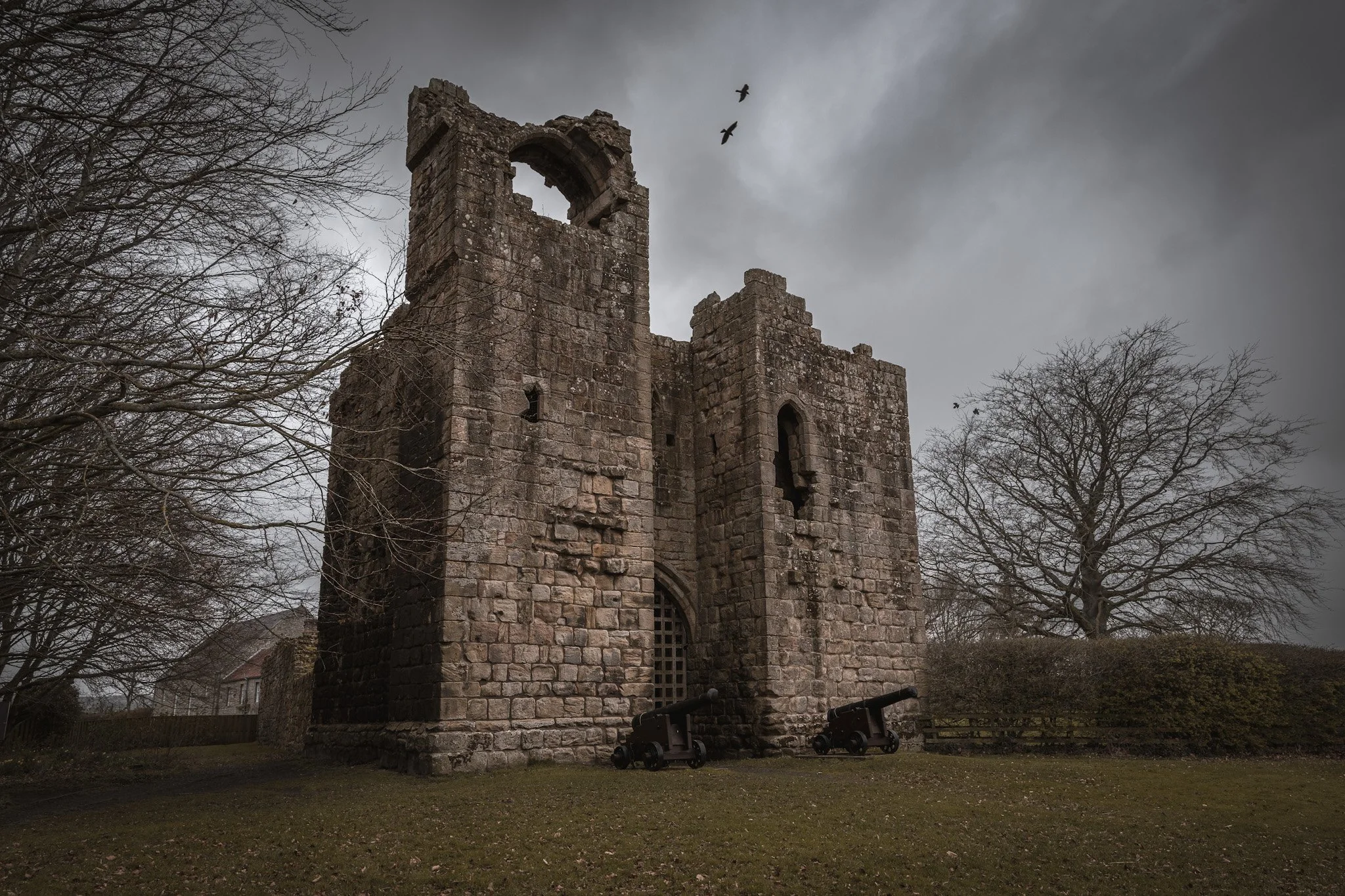
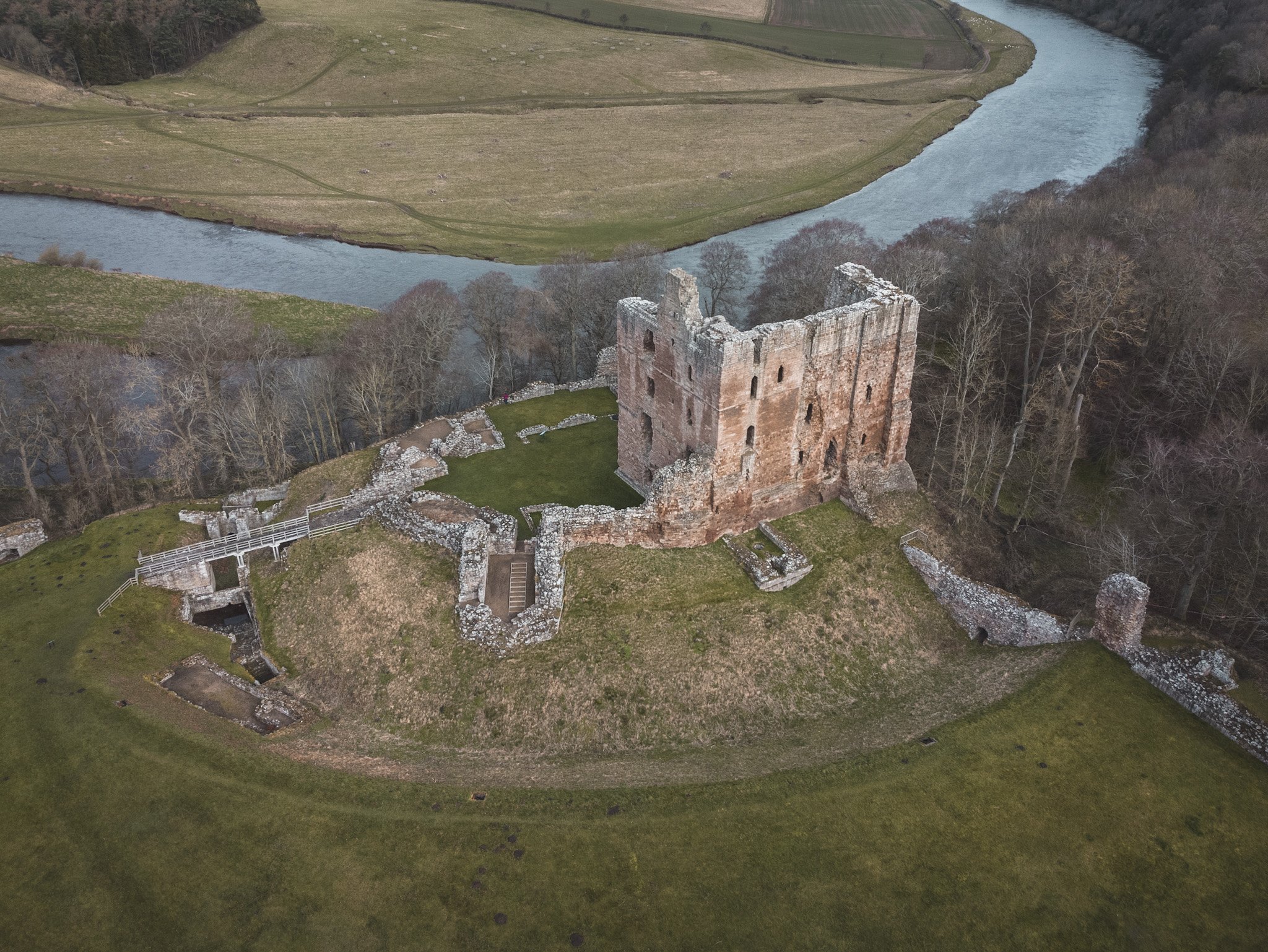
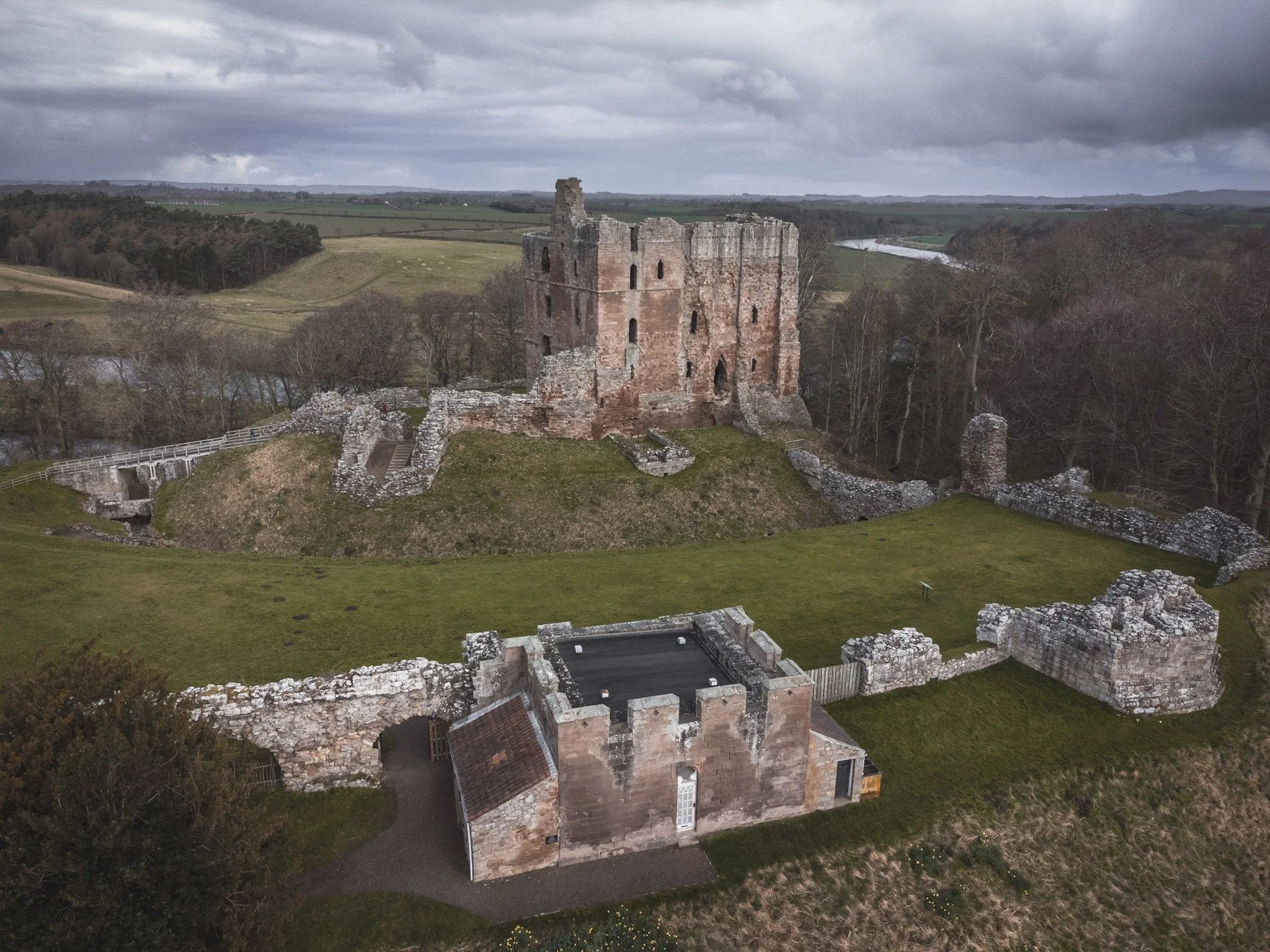
Dunstanburgh
A 14th-century fortification on the coast of Northumberland in northern England, between the villages of Crater and Embleton. The castle was built by EarlThomas of Lancaster between 1313 and 1322, taking advantage of the site's natural defences and the existing earthworks of an Iron Age fort.
Dunstanburgh's defences were expanded in the 1380s by John of Gaunt, the Duke of Lancaster, in the light of the threat from Scotland and the peasant uprising of 1381.
The origins and the earliest known use of the name "Dunstanburgh" remain unknown.Versions of the name, "Dunstanesburghe" and "Donstanburgh" were however, in use by the time of the castle's construction. And the name Dunstanburgh could have it’s origins in a combination of the name of the local village of Dunstan, and the Old English word "bruh", meaning fortress.
The curtain walls enclose 9.96 acres (4.03 ha), making it the largest castle in Northumberland. The most prominent part of the castle is the Great Gatehouse, a massive three-storey fortification, considered by historians Alastair Oswald and Jeremy Ashbee to be "one of the most imposing structures in any English castle".

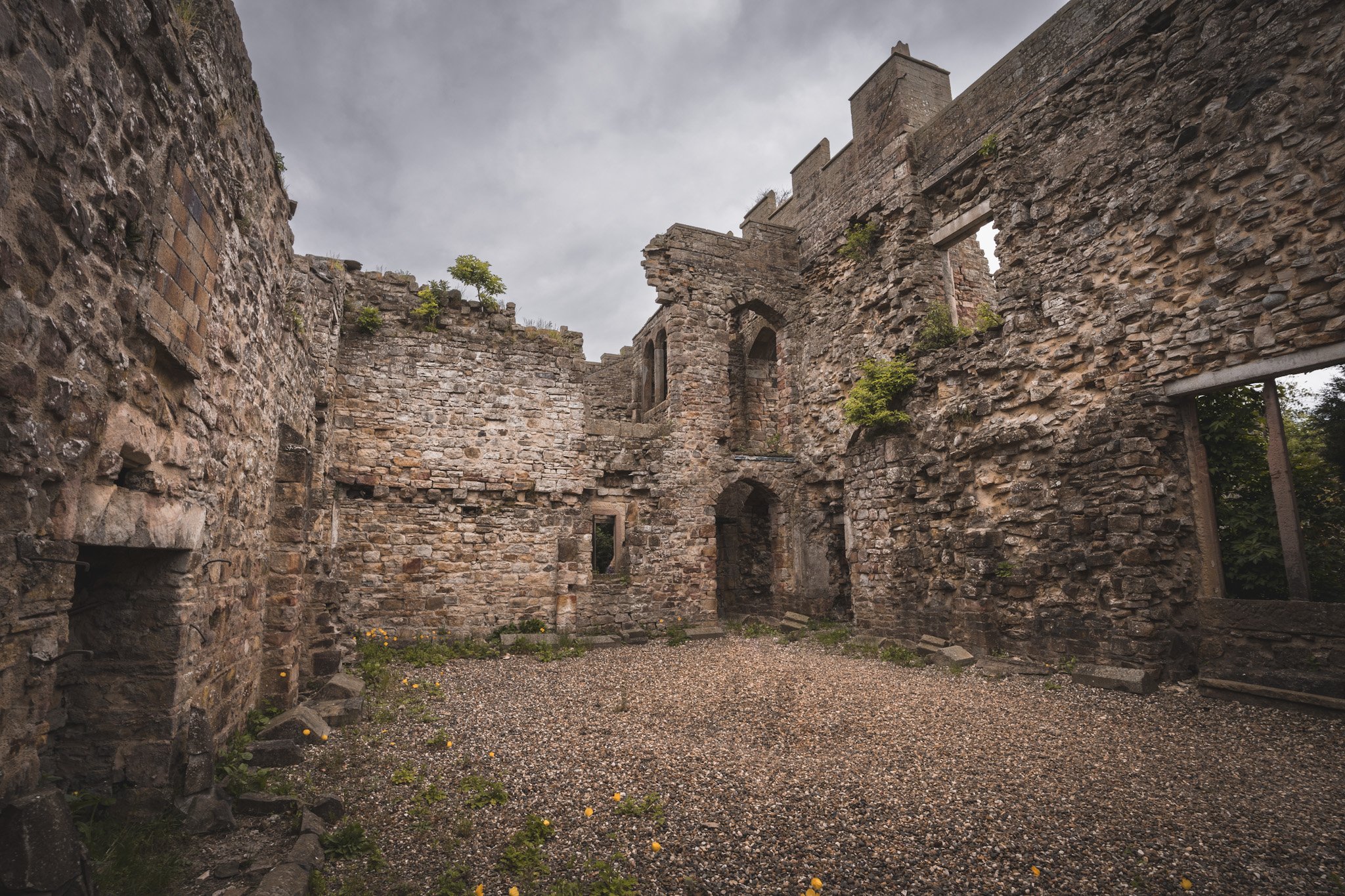
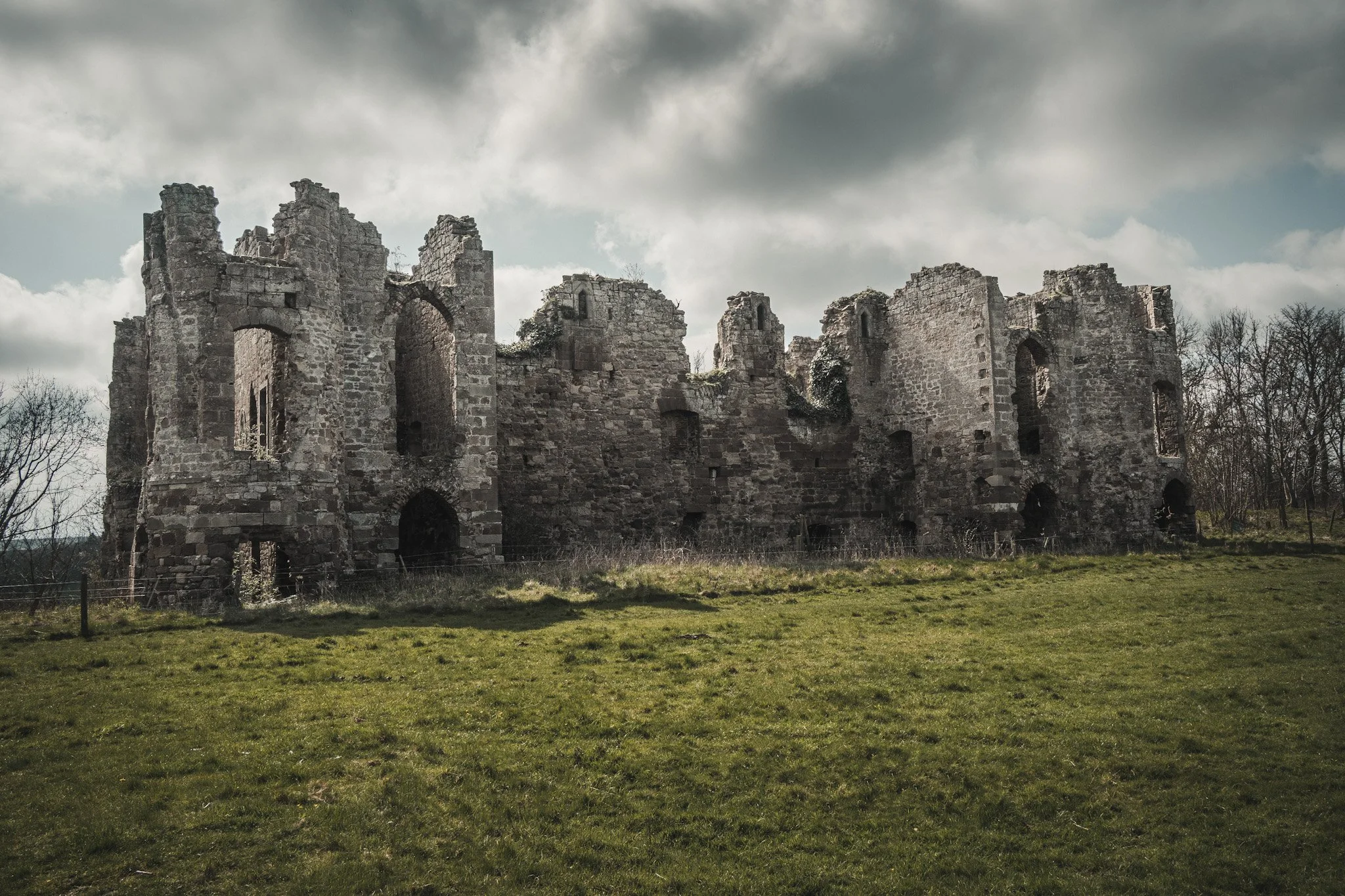
Edlingham
Edlingham castle is located in a valley to the west of the town of Alnwick. The castle dates mainly from the 14th century, although a manor house of the 13th century is probably concealed beneath later building work. The earliest standing remains are those of the hall house, built about in 1300 by Sir William Felton at a time when Northumberland was relatively peaceful.
By 1174, a John of Edlingham owned a manor house at this location. In 1294, a descendant, Walter of Edlingham, sold it to William de Felton. He strengthened it by building strong ramparts and a gatehouse, fortifying the main hall, and adding other buildings inside a courtyard
Its fortifications were increased in response to the border warfare which raged between England and Scotland in the period from about 1300 to 1600.

Elsdon
All that remains of Elsdon Castle is the motte and bailey earthworks, but as far earthworks go, they’re pretty impressive ones.
In fact, this is about as perfect a specimen of a motte and bailey fortification as you can find anywhere in northern England, towering over picturesque Elsdon village and easily visible no matter which direction you approach the settlement from.
The castle was built in c.1080 by Robert de Umfraville to guard the surrounding Redesdale region, before being superseded by Harbottle Castle (itself now also a ruin) a few miles to the north.
Umfraville, was a relative of William the Conqueror who wanted someone he could trust on the northern frontier of his new kingdom. He named Umfraville as the Lord of Redesdale and exempted him from military service on the condition that he guard his territory against robbers and wolves.
Eshott
The site of the remains of a moated fortified house of medieval date, situated at the confluence of Longdike Burn and Eshott Burn. It is visible as a sub-rectangular enclosure.
The enclosure is surrounded by a moat with an approximate width of 20ft, which is visible as a slight earthwork on the north and west sides and a well-defined earthwork on its east and south sides. The south side retains the remains of a causewayed entrance. Within the interior of the enclosure there are the remains of low earthworks.
On July 22nd 1310 the king granted a licence to Roger Mauduit to crenellate his dwelling house at Eshott. In 1358 the castle was granted to his son and in 1415 the owner was recorded as Sir John Heroun when it was listed as 'Castrum de Eshete'.
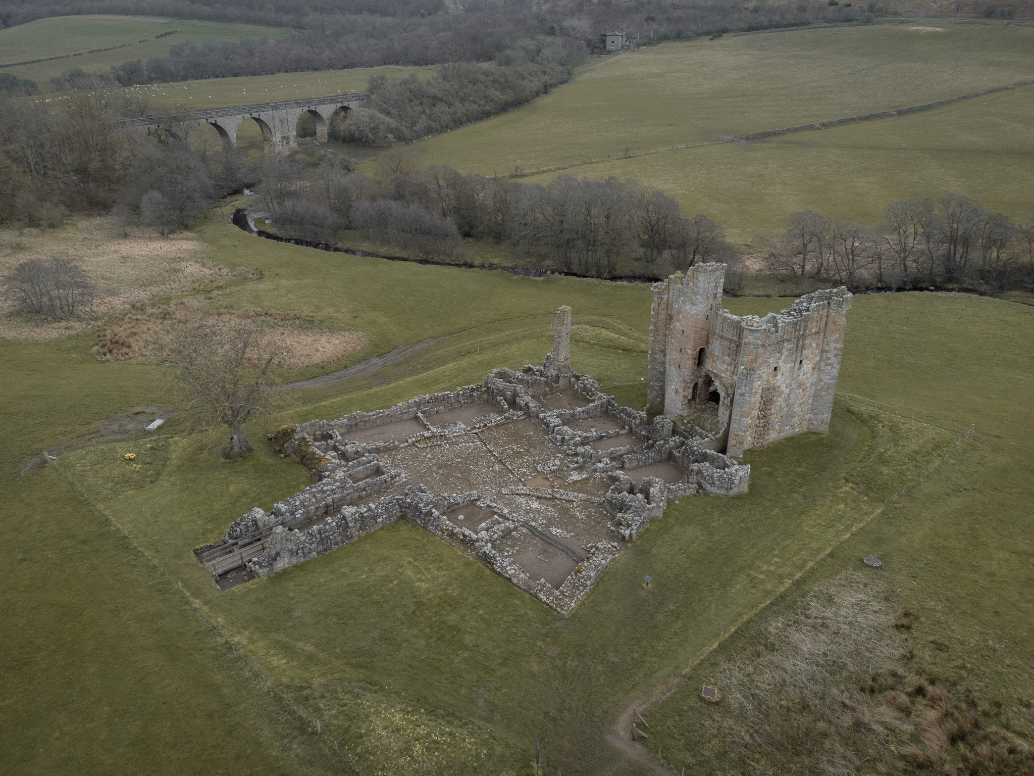
Etal
Etal Castle is a ruined medieval fortification. It was built around 1341 by Robert Manners, and comprised a residential tower, a gatehouse and a corner tower, protected by a curtain wall. The castle was involved both in local feuding and the border wars between England and Scotland. There was a battle between the rival Manners and Heron families outside the walls in 1428, and in 1513 it was briefly captured by King James IV of Scotland during his invasion of England.
In August 1513, James IV invaded England with a large army; equipped with modern artillery, he took the border castles of Norham and Wark, and then moved south against Etal Castle. Etal surrendered quickly in the hope of avoiding being pillaged by James' army, but nonetheless it was at least partially deliberately damaged to prevent it being used as a defence.
After the English victory at the Battle of Flodden the following month, the castle was retaken, garrisoned and used by Lord Dacre to store the captured Scottish artillery, under the guard of Sir Philip Tilney.

Featherstone
In the 12th century the manor house on this site belonged to the Featherstonehaugh family. It played an important role in the battles between the English and the Scots, during the Middle Ages.
The current structure began life originally as a 13th-century hall house, a square three-storey pele tower was added in 1330 by Thomas de Featherstonehaugh.
A survey from the year 1541 reported the property to be a tower in good repair, occupied by Thomas Featherstonehaugh.
Ford
Ford has a quadrangular courtyard. The licence to crenellated was granted in 1338 and making Ford the earliest quadrangular castle in Northumberland. Of the four original corner towers, three survive today.
The castle was converted into a mansion house in 1694 and given Gothic style detailing in 1761 by George Raffield for Sir John Hussey Deleval. It was restored to 17th century style and a new north wall added. It is constructed mainly of ashlar with medieval squared stones and graduated Lakeland slate roofs.
King James's tower is the largest and is at the N.W. corner, the S.W. tower is isolated, and that at the N.E corner submerged in later buildings. The fourth is completely gone now and lost to time. A wooded valley was laid out as a wild garden and crossed by bridges. The castle stands on a plateau and in the north-west corner is a small formal garden.
Today the castle is used as a field study centre for children and is generally not open to the public.
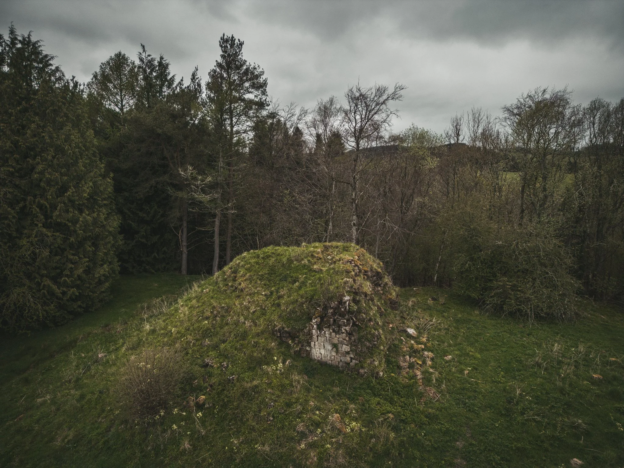
Gunnerton Money Hill
Standing above the confluence of the Coal and the Gunnerton Burns, in Dungill Wood. Mid C12 Norman motte and bailey castle surviving as an earthwork.
Thought to have been erected by Ralph de Gunnerton, the conical motte stands to a height of approximately 5m and measures 30m across at the base and 10m across its circular top. There is a large hollow 3m across at the top of the motte, the result of partial C19 excavation. A ditch 2.5m wide surrounds the motte.
The bailey lies to the east of the motte. The name of "Money Hill" derives from a tradition of supposed hidden treasure and may account for the hollowing out of the motte. Dungill Wood

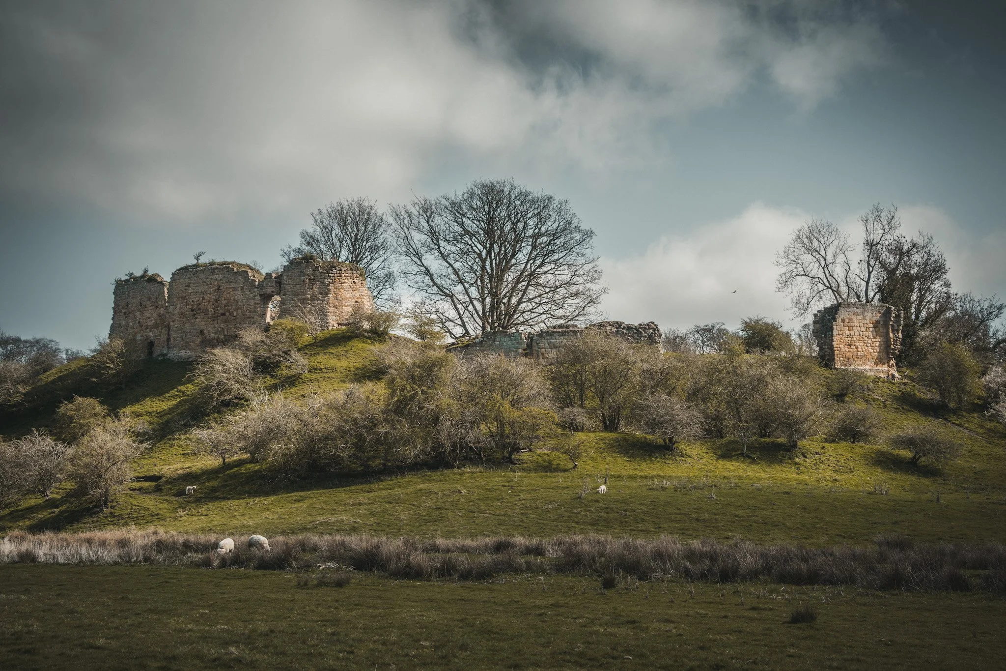
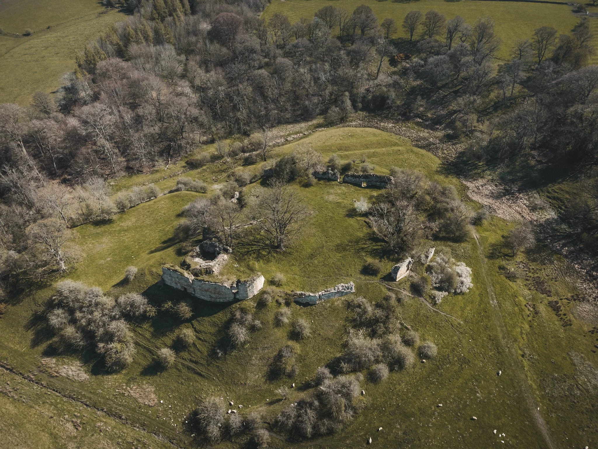
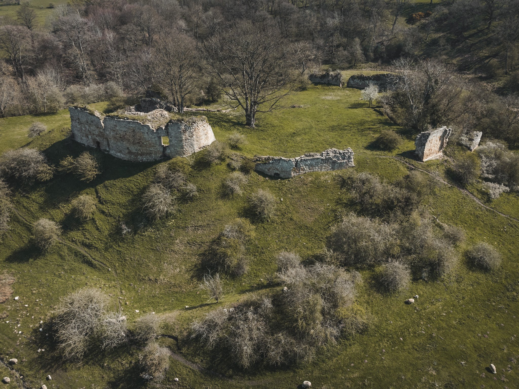
Harbottle
Harbottle Castle is a ruin perched above the village of Harbottle in the North of Northumberland, and overlooks the River Coquet. It is believed that the mound on which the keep stands was a site used by the ancient Britons and that in Saxon times was a stronghold on the site held by Mildred, son of Ackman.
The present castle remains were constructed in 1157 under orders from King Henry II. The motte itself, is over forty feet high and surrounded by a ditch 6 feet deep. The outer bailey was also surrounded by a deep ditch over 30 feet deep internally and more than ten feet externally.
In 1296 the castle was besieged by a force of some 40,000 men under the command of Robert de Ros. Despite this enormous force the garrison withstand the siege. It was finally captured by Robert The Bruce and destroyed only to be retaken and restored.
Parts of the curtain wall still survive along with extensive earthworks.
Haughton
Originally built in the 13th century as a tower house and later, enlarged and fortified in the 14th century.
By the 16th century, the castle fell into ruin and disrepair, and it was attacked by Border Reivers. A survey conducted in 1541 reported the roof and floors to be "decayed and gone"
Significant alterations were carried out for the Smith family between 1816 and 1845, latterly by architect John Dobson to convert the ruin into a substantial mansion.
Heaton
Remains of a quadrangular castle founded in 1328-40 destroyed in 1496 and then again, in 1513 by King James IV. The surviving remains consist of two buttresses set against the north east wall of the stable and the probable remains of a turret and rampart. The site is now covered by farm buildings.
The C14 castle went out of gentry use by 1559 but the remnants seems to continued as a pele-house type building.
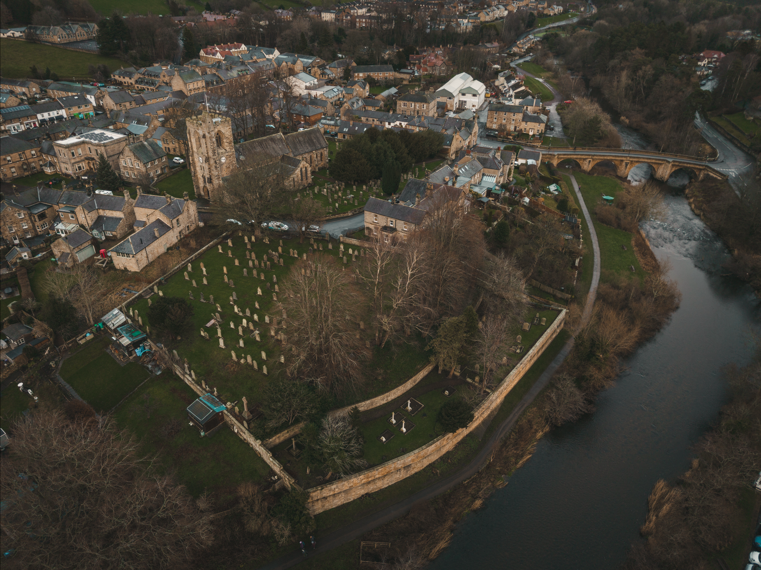
Hexham
The exact date of the construction of the hall stands in the Market Place of Hexham town centre, is uncertain. A 1355 document refers to the ‘chamber of the bailiff and the hall of pleas’ as being in ruinous condition. From this it would reasonable to assume that a building for the transaction of manorial business had been in existence long before 1355.
The building may have been a fortified structure similar to that which now existing. The same document ordered that the building be repaired but it is not known if the old structure was patched up, or partly demolished to allow for the present building to be erected.
The Moot Hall is in good condition and used to house the Brough Library. The house at the angle of Market Place and Hall Stile Bank is now completely demolished and no trace of any masonry that could be associated with a precinct wall of the outer enclosure or bailey remains.
Projecting from the east wall of the Moot Hall, and bonded to it, is a fragment of walling, possibly part of the precinct wall.
Kielder
Kielder Castle, was originally a hunting lodge of the 1st Duke of Northumberland, constructed in 1775.
Romantically seated at the junction of the Kielder Burn and the North Tyne, it is quadrangular with a castellated front, and commands a fine view of the river and surrounding country.
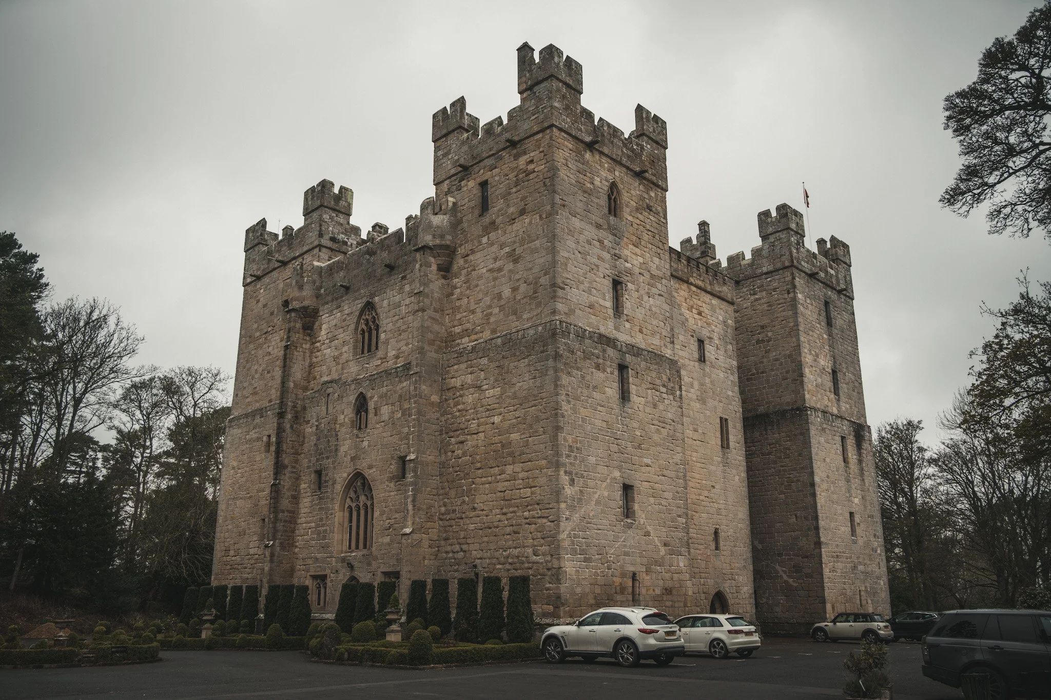
Langley*
Langley Castle is a restored medieval tower house, now used as a hotel, situated in the village of Langley in the valley of the River South Tyne.
Built in the middle of the 14th century by Sir Thomas de Lucy as a great H plan H-shaped tower of four storeys. Before this the site was the seat of the Barons of Tynedale in the 12th century, from whom descend the Tyndall family. It was attacked and severely damaged in 1405 by the forces of Henry IV in the campaign against the Percys and Archbishop Scrope.
It remained as a ruin until it was bought and restored by a local historian, Cadwallader Bates, in 1882. Bates died in 1902 and his wife Josephine continued the restoration.
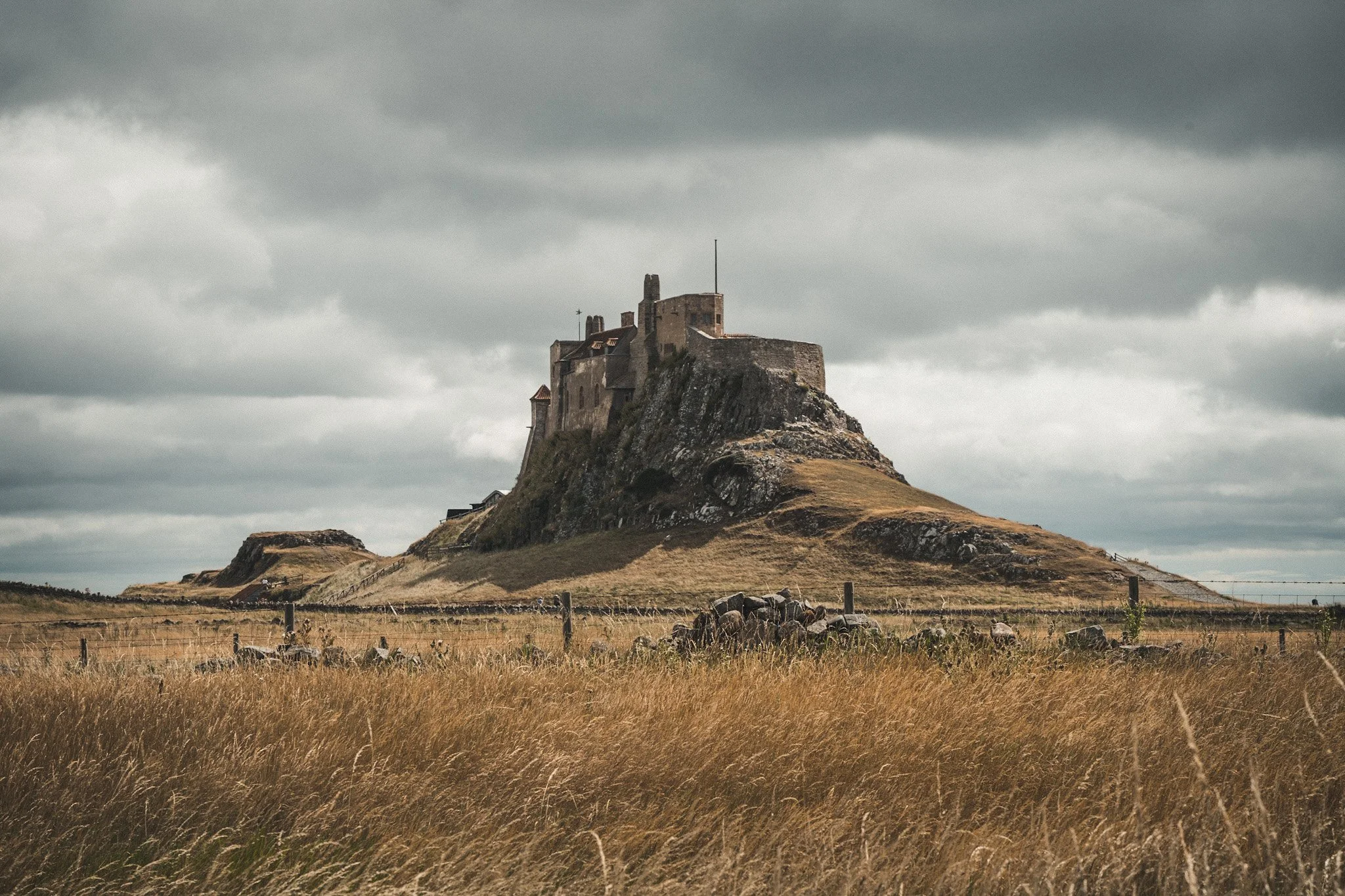
Lindisfarne
Lindisfarne Castle is a 16th-century castle located on Holy Island, much altered by Sir Edwin Lutyens in 1901. The island is accessible from the mainland only at low tide across a causeway and is completely cut off from the mainland twice each day, at high tide.
The castle is located in what was once the very volatile border area between England and Scotland; the area was also frequently attacked by Vikings.
Taking advantage of the island's strategic location, in 1549, a small fort was built on a high rock known as Beblowe, the highest point of the island, to the north of the monastic buildings, and overlooking the harbour. Military engineer Sir Richard Lee saw only a decayed platform and turf rampart when he inspected the area in 1565. Elizabeth I, then had work carried out on the fort, strengthening it and providing gun platforms for the new developments in artillery technology. These works in 1570 and 1571 cost £1191.
Lowick
Nothing remains of the structure at Lowick, just earthworks of a ring-shaped enclosure with single rampart. Area approx. 1/4 acre. The situation is on the tip of a promontary formed by the junction of two small valleys a little over the 200 foot contour. The main earthwork has been formed by cutting off the promontory by a deep ditch.
There is a gap, possibly an entrance, on the south side. The bracken-covered interior shows no traces of occupation. The situation is on level ground with the natural slopes of a small valley immediately to the west
Ogle
The medieval village and moated site at Ogle are well preserved and retain significant archaeological deposits.
The historical context of the monument is recorded in several documents and it is known that from the 12th century until the late 16th century the manor was held by the Ogle family before descending to the Cavendish family. An estate map of 1632 shows that at this time the village comprised 16 houses and a castle.
The original medieval buildings are thought to have included a tower with an attached manor house as licence to crenellate was granted in 1341 and a document of 1415 lists the existence of a 'castrum' at Ogle.
Mitford
Mitford castle dates from the end of the 11th century and located on top of a hill in the village, west of Morpeth. It is a Scheduled Ancient Monument.
The Norman motte and bailey castle stands on a small prominence, a somewhat elliptical mound, above the River Wansbeck. The selected building site allowed for the natural hill to be scarped and ditched, producing the motte.
Prior to the 1066 Norman conquest, the castle was held by Sir John de Mitford, whose only daughter and heiress, Sybilla Mitford, was given in marriage by William the Conqueror to the Norman knight, Richard Bertram. In the late 11th century, it was an earthwork fortress of the Bertram family, and of record as William Bertram's oppidum in 1138. In 1215, it was seized by the English King John’s troops. In 1264, the castle was held by the third Roger Bertram, but in that year, it was seized from him and committed to the custody of William de Valence, 1st Earl of Pembroke, King Henry’s half-brother.
There are conflicting accounts over the castle's destruction. One theory is of a fire during Middleton's rebellion. Another theory is that it was destroyed by the Scots in May 1318 during Middleton's imprisonment in the Tower of London. It was certainly destroyed by 1323 as records of an inquest held that year after the death of its then owner Ajmer de Valence, Earl of Pembroke, state Mitford Castle to be "entirely destroyed and burnt."
Morpeth
My home town, so this one is pretty special. The original motte and bailey, dating from the 11th century was built on a hill overlooking the River Wansbeck and destroyed by King John in 1216. A new castle was built in the bailey of the original in the 1340s, but little of that structure survives apart from parts of the curtain wall and the much-altered gatehouse.
In 1516 Margaret Tudor, sister of Henry VIII and widow of James IV of Scotland, stayed for four months in Morpeth Castle as she fled from her enemies in Scotland and sought refuge with her brother. The one great military event in the castle's history was in 1644 when a garrison of 500 Lowland Scots held it for Parliament for 20 days against 2,700 Royalists.
Today the the gatehouse is available to rent from the Landmark Trust, as holiday accommodation.

Morpeth (Ha Hill)
Ha' Hill (Or Haw Hill) is scheduled monument in Carlisle Park which was the site of a motte and bailey castle, being Morpeth’s first castle.
The castle was built by William de Merlay around 1080 after being granted the barony of Morpeth. The earliest documentary reference to the castle is in 1095 when it was captured by William Rufus. Originally constructed as a wooden structure, being replaced later by a stone castle in the same location.
The stone castle was burnt down by King John in the 13th century and the castle was rebuilt on the adjacent hill, which still stands today as Morpeth Castle (visible in the background of the above image).
Nafferton
The castle is visible as a substantial rectangular enclosure, which measures a maximum of 148ft east to west by 236ft north to south within a rampart 20ft wide and a ditch 35ft wide on the northern and western sides; the eastern side of the enclosure is afforded natural defence by the steep slopes above the Whittle Burn and the south side is defended by a natural ravine, now partially infilled, with a substantial rampart to its south.
There is a well preserved entrance through the centre of the northern and western ramparts. Documents record the existence of a castle at the site by 1218, when its owner Philip of Ulecotes was ordered to demolish a new wooden tower which was being constructed without licence.
In 1221 the tower, which despite the earlier order was still standing, was ordered by the King to be dismantled and its timbers were removed to build a new gaol at Newcastle upon Tyne.
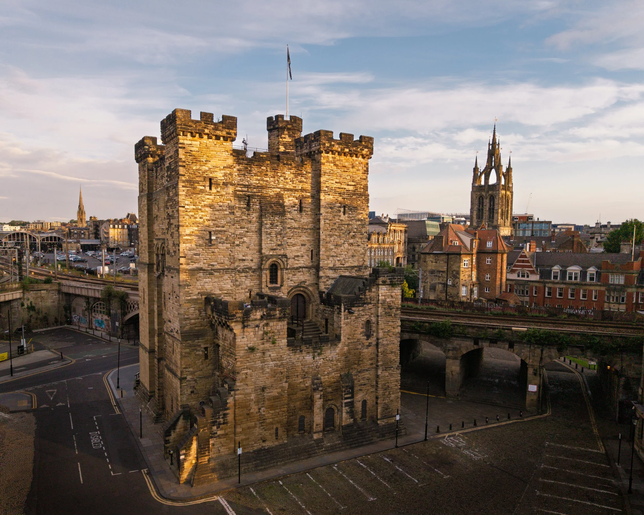
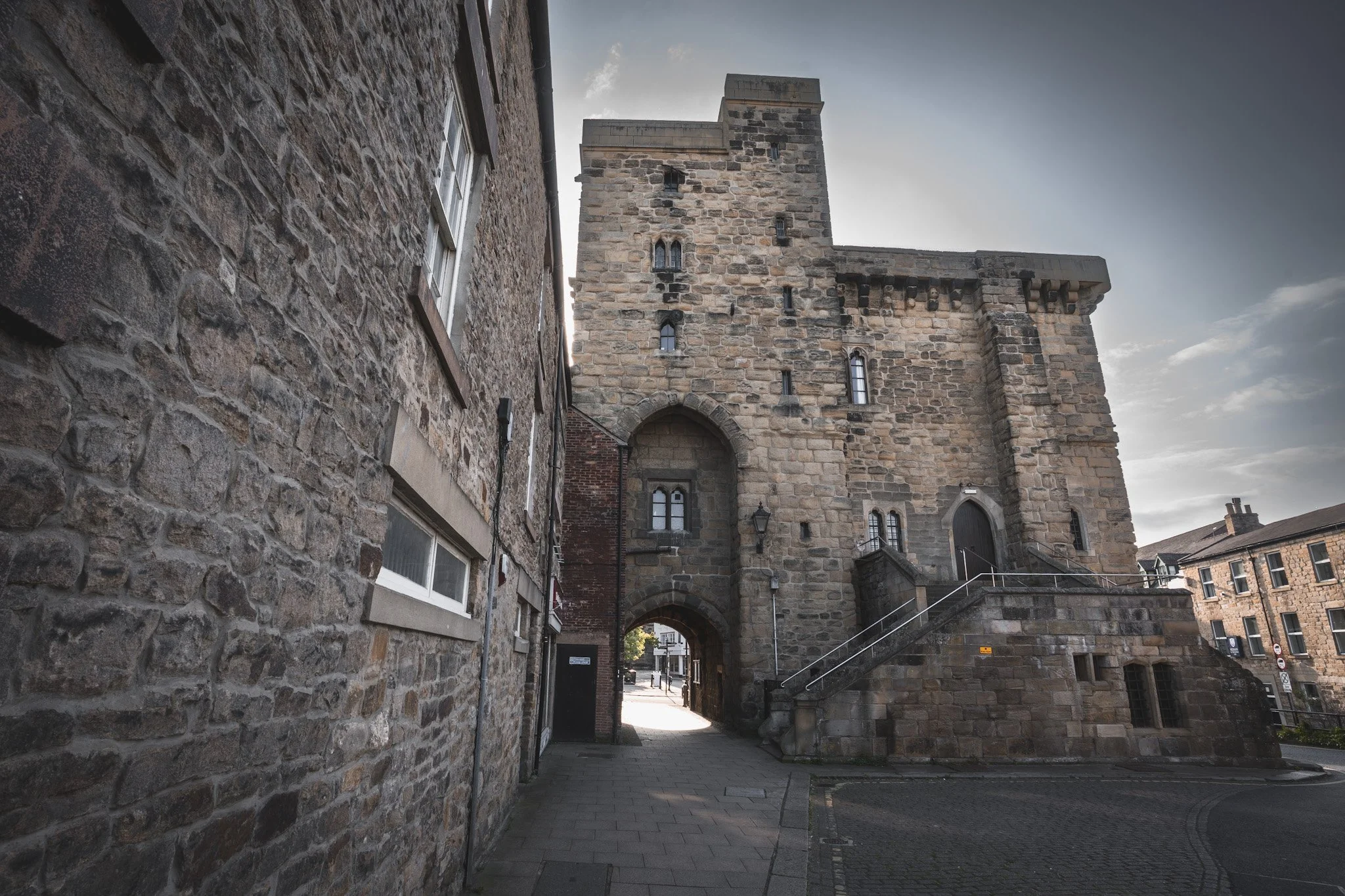
Newcastle
Newcastle Castle's history is rooted in both Roman and Norman fortifications. And while the Newcastle we know today isn’t in Northumberland, it was squarely in the Kingdom of Northumbria. Initially, a Roman fort named Pons Aelius stood on the site, built c.122AD.
In 1080, Robert Curthose, son of William the Conqueror, built a motte-and-bailey castle (a wooden fort on an earth mound) on the site, which was then called "New Castle".
The stone castle keep was constructed between 1172 and 1177, replacing the earlier wooden structure. The Black Gate, a barbican, about a hundred yards north west of the keep, was added later, around 1247-1250, visible in this image just below the cathedral tower.
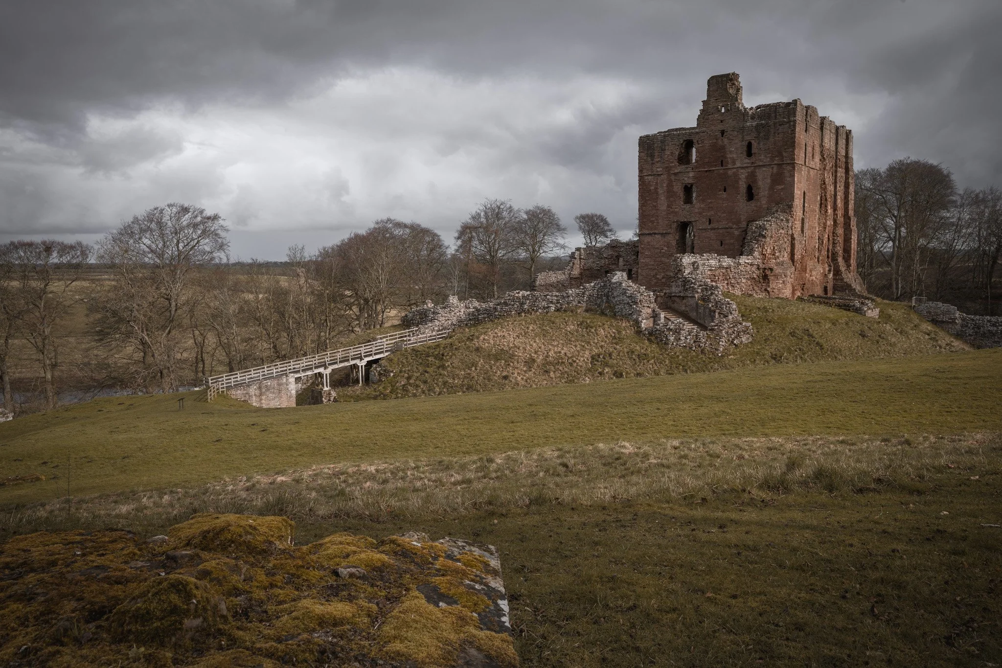
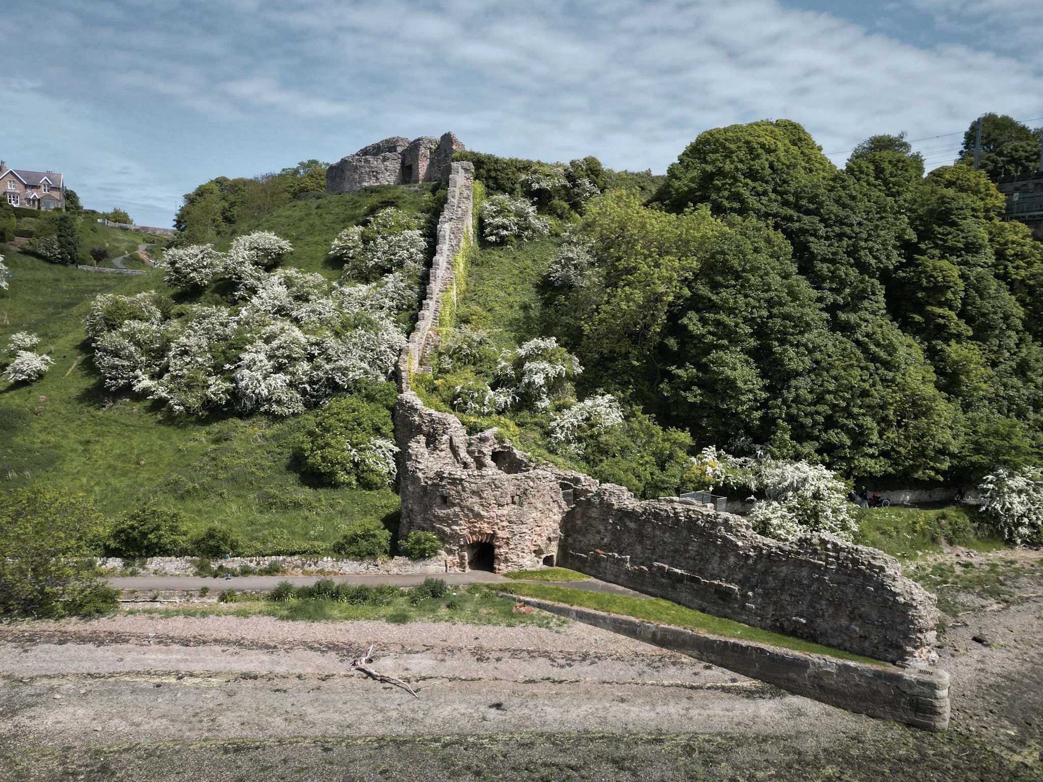
NORHAM
The castle was built in 1121 and saw much action during the wars between England and Scotland.
The castle stands proudly on the south bank of the River Tweed, high above the river on the border between England and Scotland. It was positioned, so that the north side is protected by a steep slope. A deep ravine protected the east side and an artificial moat was dug round the west and south sides to complete the protection. The castle had an inner and outer ward. The inner ward stood on a mound and was separated from the outer ward by a moat, crossed by a drawbridge.
The main entrance to the castle was the strongly fortified West Gate leading into the outer ward. It was protected by a stone causeway spanned by a drawbridge and is also known as "Marmion's Gate". There was an additional gate to the south of the outer ward, known as the Sheep Gate.
The inner ward was entered by crossing a drawbridge across the moat and entering through a fortified gate on the west side. The drawbridge has now been replaced by a wooden bridge.
Otterburn
Otterburn Tower was built on the site and using some of the stones from Otterburn Castle. Otterburn Castle, as it was originally known, was founded by a cousin of William the Conqueror in 1086 as a bastion to repel the Scots.
In August 1388, during the Battle of Otterburn, initially, the Scottish forces had camped near the Redsdale valley close to the tower, in the evening. The next day, early in the morning, they attacked the Otterburn Tower but were unsuccessful in their attempt to capture it.
One of its notable owners was Mad Jack Hall, a Jacobite rebel who was tried five times and finally executed at Tyburn for high treason on 13 July 1716, and his initials are still carved over one of the original doors.
Thomas James built the current Otterburn Tower over what was Otterburn Castle incorporating the masonry of an 18th-century house which contained an early building. No traces of the original castle remain.
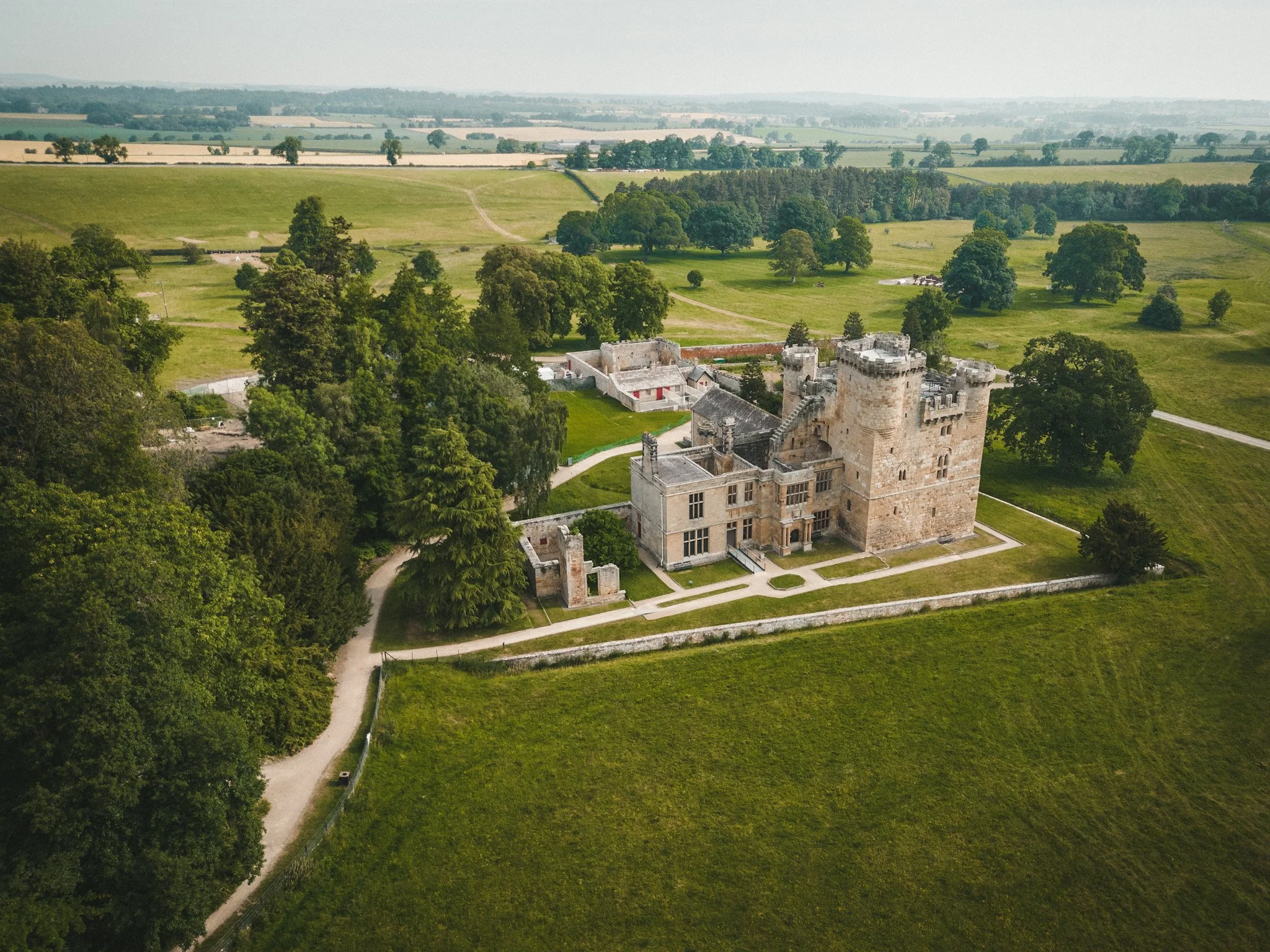
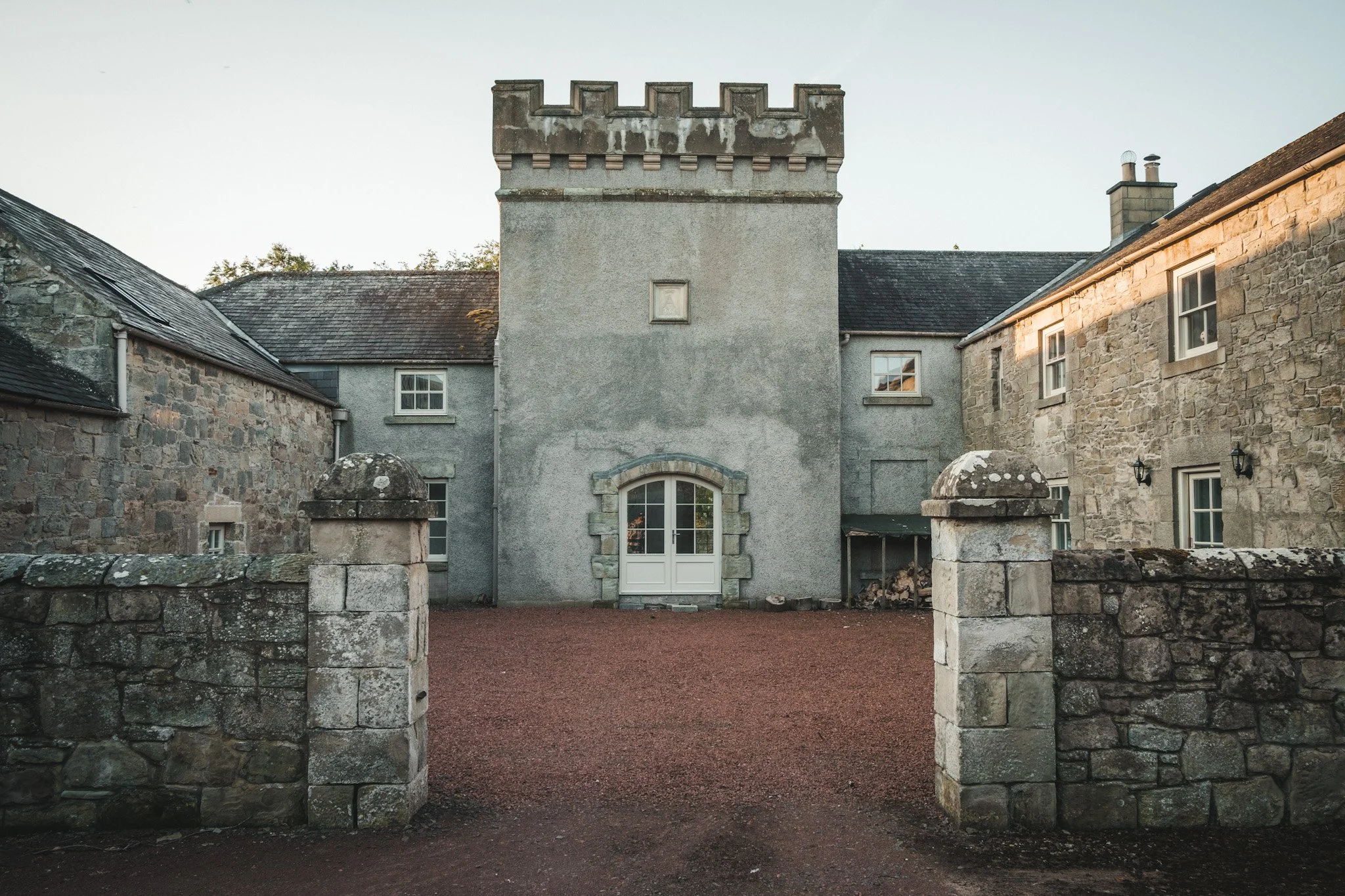
Prudhoe*
Prudhoe Castle is a ruined medieval castle on the south bank of the river Tyne. Excavation has established the original construction was a Norman motte and bailey, built sometime in the 11th century, most likely after the normal conquest in 1066.
It is partly enclosed by a deep moat. The ground to the north falls away steeply to the river. The castle entrance is on the south side and is flanked by a mill pond on the left and a ruined water mill on the right. The castle is entered by a barbican dating from the first half of the 14th century. The gatehouse, dating from the early 12th century, leads into the outer ward; which contains the remains of several buildings.
The castle was continuously occupied for over nine centuries. It was originally the home of the Umfravilles but was eventually taken over by the famous Percy family who restored it. Prudhoe survived two sieges during the 1170s and was the only Northumberland castle to resist the Scots.
Rothbury
The Haa Hill graveyard in Rothbury is located at the south-west of All Saints Church by Haw Hill and Church Street on a knoll overlooking the River Coquet.
This the site of Rothbury Hall, which is considered to be Rothbury Castle, built after the Norman Conquest, and first documented in 1265. The Hall was described as having massive walls and stone arched vaults, consistent with a defensive castle or tower house. Though in ruins by 1843, parts of the building were still occuied upto c.1850.
It was demolished with the foundations dug out and mound levelled, when the new churchyard was laid out in 1869. There are now no remains of the building to be seen.
Rothley*
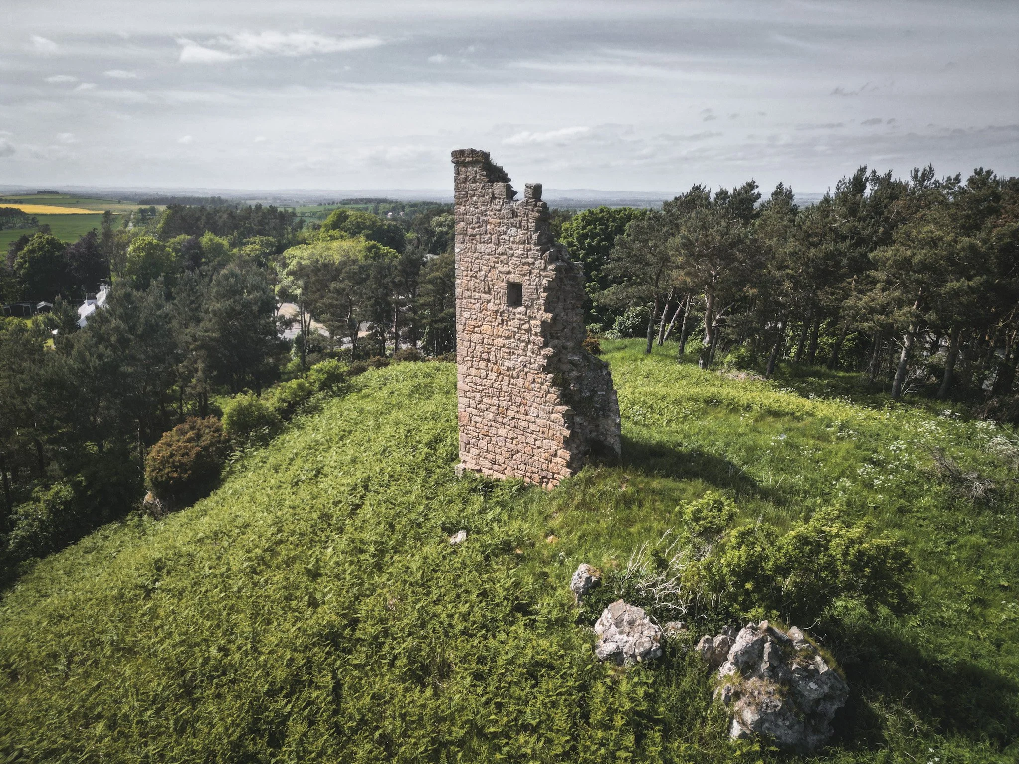
Rothley Castle is an 18th-century gothic folly built to resemble a medieval castle, situated at on an elevated crag at Rothley. It is a grade II listed building.
It was designed in 1755 by architect Daniel Garrett for Sir Walter Blackett, owner of Wallington Hall, from where it is visible on the skyline. A genuine medieval tower, known as Rothley Tower (which stood nearby), was demolished, probably early in the 19th century.
A similar gothic folly, also part of the Wallington estate, is Codger Fort, on crags about a mile north of Rothley Castle. It is in the form of a triangular gun battery, and was designed by Thomas Wright of Durham.
Simonburn
On a promontory between the Castle Burn and Hopshield Burn, is an unfinished motte and bailey. Probably begun in 1136 by Simon de Senlis, Earl of Huntingdon.
A dwelling here was first mentioned in 1293 when it passed from Henry Graham to Adam Swinburne. The 1415 Survey shows it in the hands of the Herons.
Remains of C13 tower house partly reconstructed as an eyecatcher in 1766, surviving as a ruined building of which the upper storeys have now collapsed. The tower was built of small stone blocks. Only the barrel vaulted ground floor of the tower survives, with the remains of a turret on the north west side.
Recorded in 1541 survey as 4 storey strong tower in good repair standing on very strong ground. It was abandoned in c1700 in favour of Chipchase.
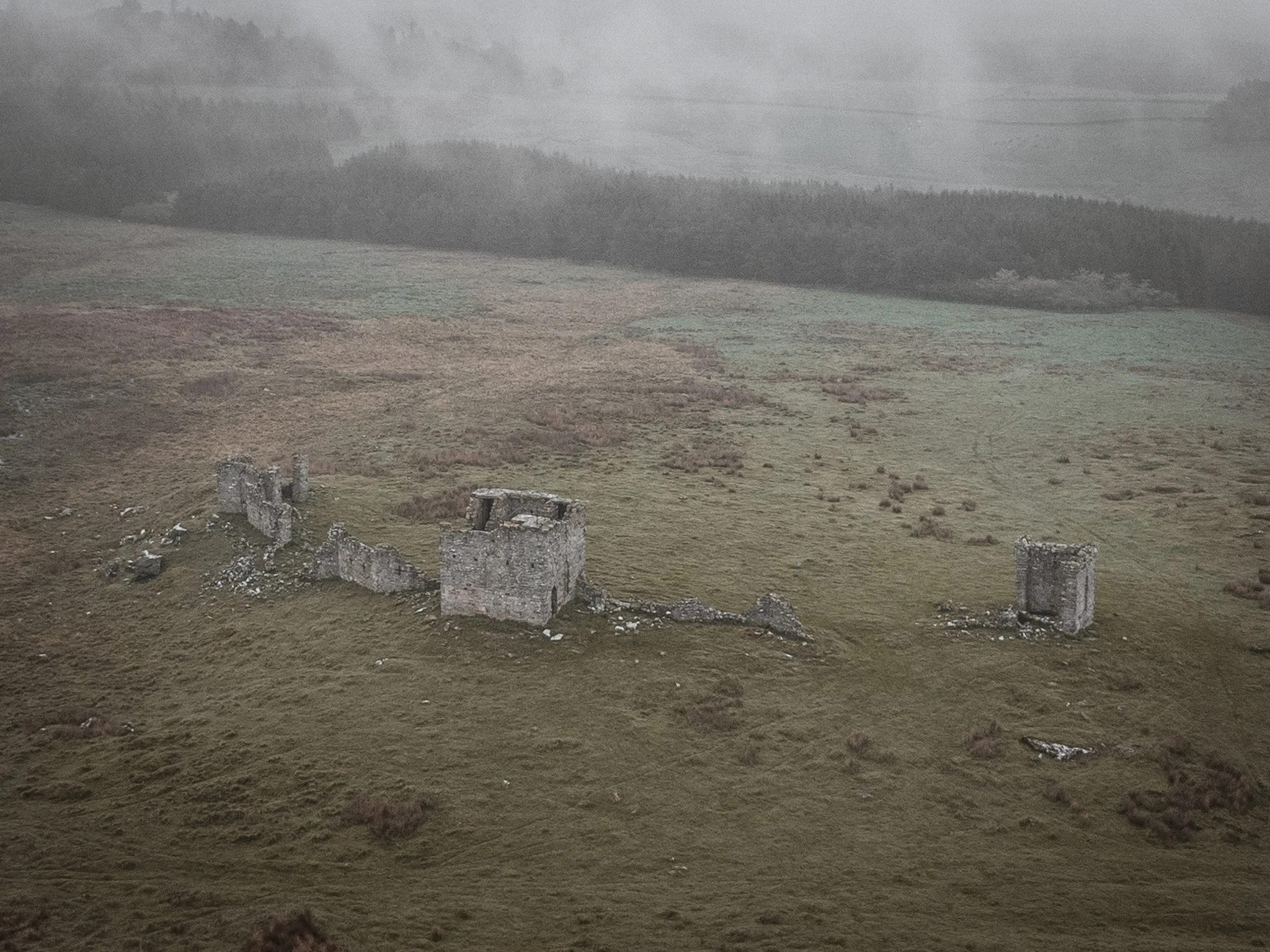
Sewingshields
Site of Sewingshields Castle, which belonged to Sir Robert Ogle, who died in 1437 and was probably only a simple tower. There are no visible remains, though it appears to have been defended on the west side by a single ditch.
The exact form of this 'towre' is not known. The proximity to Hadrian's Wall would suggest it was of reused Roman masonry - as reported by Sir John Clerk in 1741.
There are no visible remains of the tower.
Styford
Henry I granted the lands here to Walter de Bolbec (d c.1133), which remained with his descendants until 1262. He may have founded the castle sited here. This is one of the suggested sites of the castle of Tiefort, which was mentioned in 1216.
A large, artificial conical-shaped mound with a strong ditch surrounding on three sides. On the south there is a steep, natural slope to the river valley below. The mound is 5m high on the east, and the summit slopes slightly upwards to 6.6m high on the west. The ditch is deepest and widest on the north where the approach is from higher ground.
The whole earthwork has been mutilated by much quarrying. Ridge-and-furrow ploughing runs up to the perimeter of the ditch.

Tarset
The remaining motte and bailey and some earthworks of Tarset Castle. The Comyns, Scottish knights were established in Tynedale in the 12th century and the manor of Tarset was granted to William Comyn in around 1222. Licence to crenellate was granted to John Comyn in 1267, the earliest surviving licence to do so in Northumberland.
John was one of the contenders for the Scottish throne in 1292 and lost his English estates in the subsequent wars. They were returned to him just before he died in 1306. His son John sided with the English and was killed at Bannockburn, after this the castle was destroyed by the Scots.
Some standing masonry is visible to a maximum height of 1.5m at the north east and south east corners of the structure standing upon the uncovered remains of a stone plinth. The house is largely visible as the grassed over remains of a rectangular structure. This masonry is thought to represent two of the four square corner turrets known to exist at Tarset Castle.
In 1523 the house was occupied by Sir Ralph Fenwick and 80 men but was taken and burnt in 1525. In the survey of 1541 the Castle was decribed as "the Hall of Lord Burrowe's inheritance, the which was Burnt by the said Tyndalles sixteen years since..."
There was an Excavation of the site in 1888 and soon afterward the stones were plundered for materials to build a cottage. There is now landslips above the burnt, which give cause for concern about the long term of the site
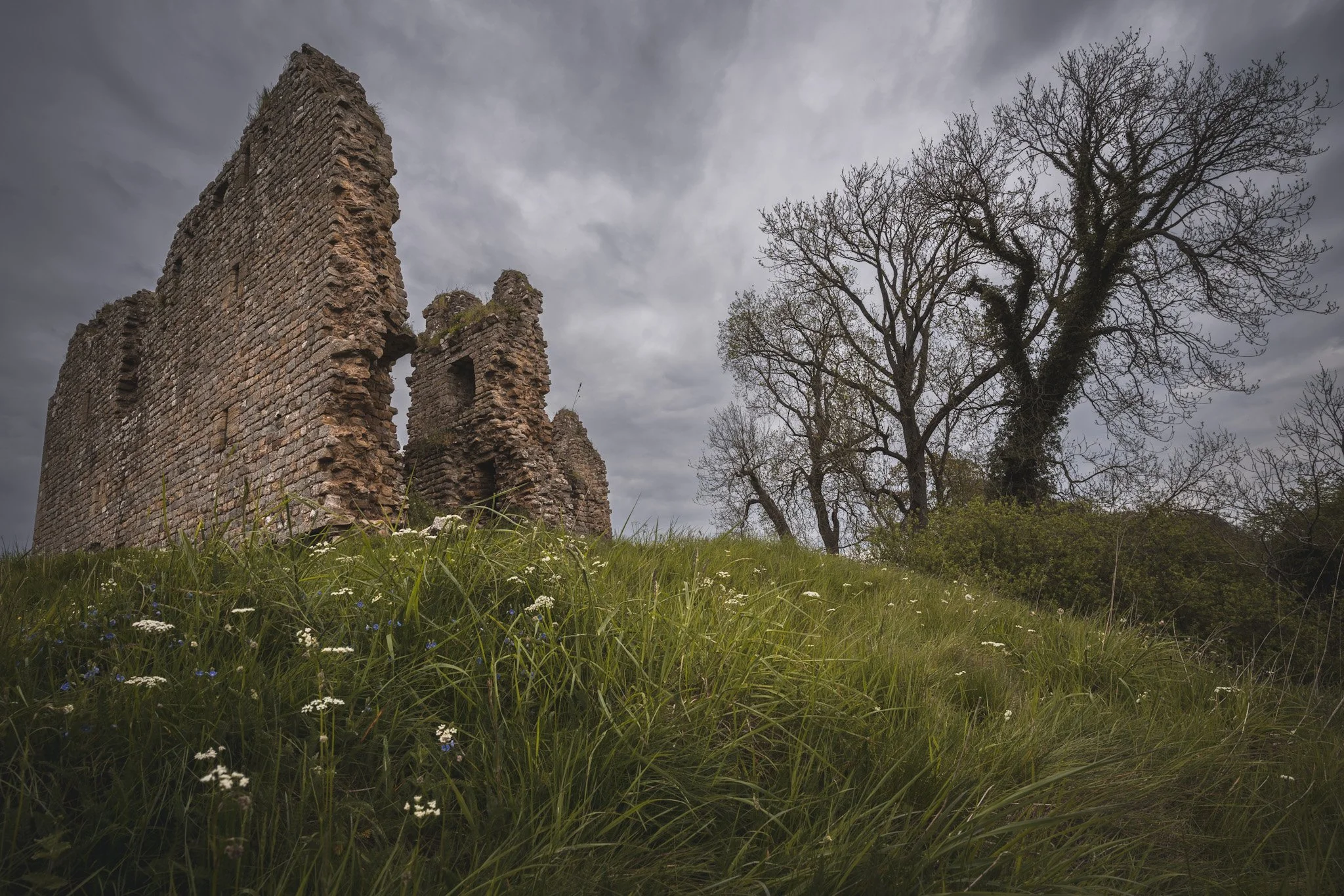
Thirlwall
Thirlwall was the centre of a barony created by King Malcolm IV between 1153 and 1165. The elected baron, who took the surname Thirlwaal, lived in a manor house built in timber, later rebuilt in stone. The 'castle', really a tower, is first documented in 1360.
The tower was never attacked by either Scots or English, and in the Civil War was commandeered by Scottish troops aiding the Parliamentarians. They damaged the fabric so much that it was not considered worth repairing. Renovation was unsuccessfully attempted in 1759, but in 1831 the east wall collapsed.
Edward I visited Thirlwall on 20th September 1306, but the first reference to the Thirlwall seat as a castrum does not occur until 1369.
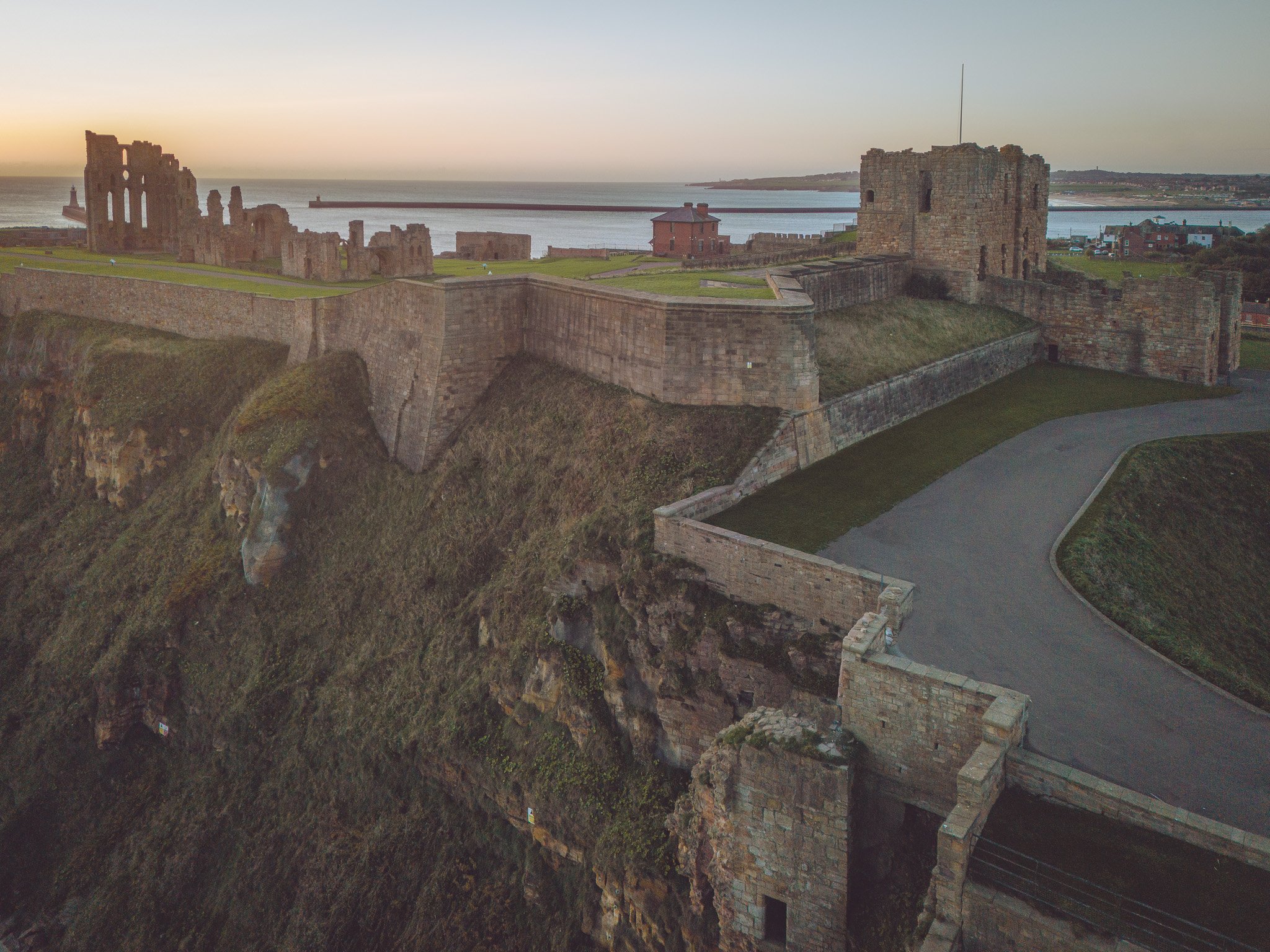
Tynemouth
Tynemouth Castle is located on a rocky headland (known as Pen Bal Crag), overlooking Tynemouth Pier and the mouth of the River Tyne. Now in the borough of North Tyneside, Tynemouth was historically the capital of Tynemouthshire, a liberty within the county of Northumberland.
The castle-towers, gatehouse and keep are combined with the ruins of the Benedictine priory where early kings of Northumbria were buried.
The Priory was founded early in the 7th century, perhaps by Edwin of Northumbria.
In 651 Oswin, king of Deira was murdered by the soldiers of King Oswiu of Bernicia, and subsequently his body was brought to Tynemouth for burial. He became St Oswin and his burial place became a shrine visited by pilgrims. He was the first of the three kings buried at Tynemouth.
In 800 the Danes plundered Tynemouth Priory, and afterwards the monks strengthened the fortifications sufficiently to prevent the Danes from succeeding when they attacked again in 832.
However, in 865 the church and monastery were destroyed by the Danes. At the same time, the nuns of St Hilda, who had come there for safety, were massacred.
Twizell
Twizel Castle is located high on a hill overlooking the River Till. Below it, the medieval Twizell Bridge spans the river. The site played a critical part in many clashes between the Scots and English and is closely linked to the crucial Battle Of Flodden. Although a medieval ruin, there is still lots of the castle left over to see.
A medieval tower house which once stood on the site was, in 1415, held by Sir John Heron was destroyed by a Scottish army in 1496 commanded by James IV of Scotland and Perkin Warbeck. James IV returned on 24 August 1513 on his way to besiege Norham Castle to the east, and held a council or parliament at "Twesil" or "Twesilhaugh."
Of the medieval structure, blocked windows, a chamfered doorway and the original north-east angle quoins are all that remains visible now.
The gardens of the castle contain the earthwork remains of the once lost medieval village of Twizell, whilst the massive ruin presents the remains of an 18th-century castle which was never completed.

Warden
The motte castle at Warden is a well preserved example of a monument type which is rare in Northumberland. Evidence relating to the nature and duration of its use will be preserved and hence the site will contribute to the study of the Norman Conquest of northern Britain.
The monument includes a Norman motte situated on the top of a natural hill commanding a prominent position above the confluence of the rivers North and South Tyne.

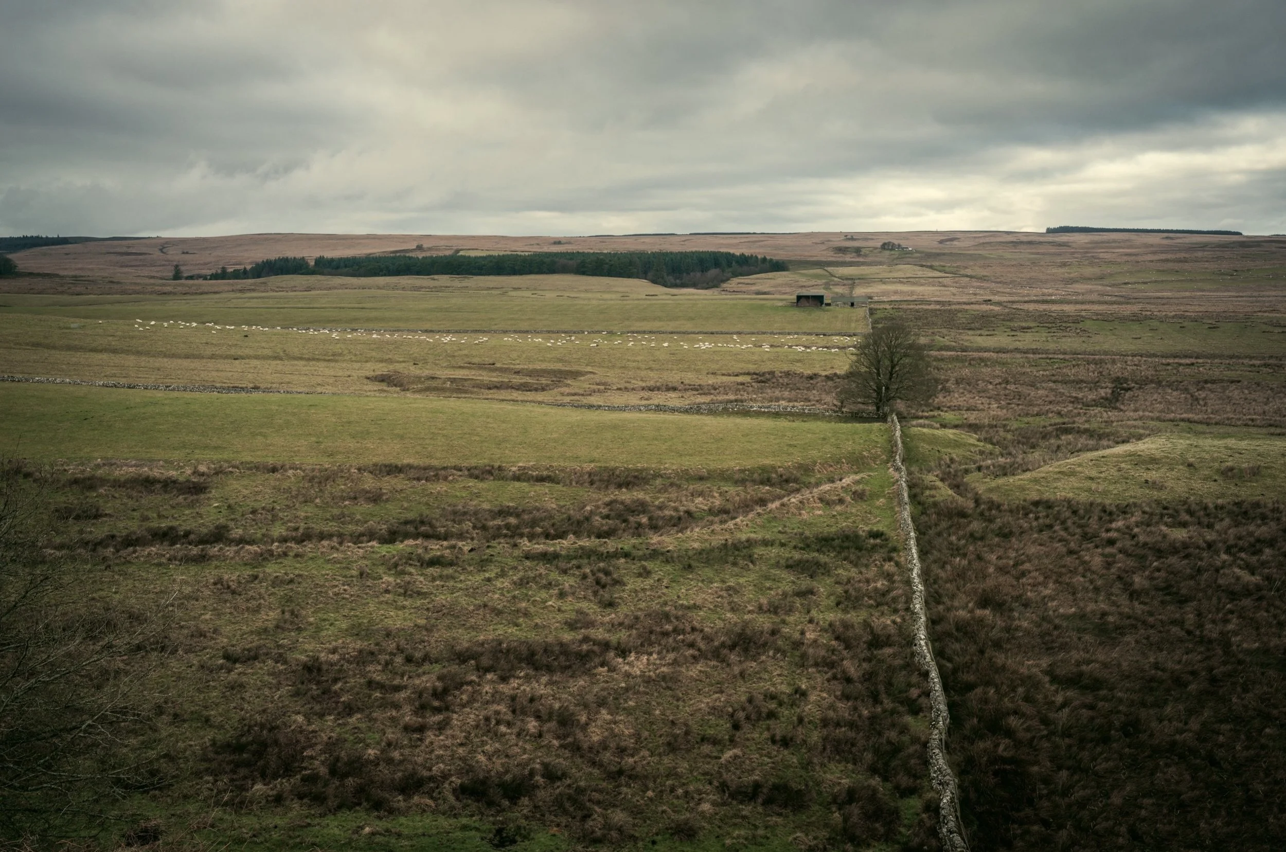
Wark
Wark-on-Tyne was the capital of the Liberty of Tynedale which comprised the whole of the two Tyne valleys north and west of Hexham. The writs of the English King did not apply to Tynedale. The presence of the two large Liberties of Redesdale and Tynedale under their powerful Lords explains the absence of any large Castles in this area now National Park.
Remains of a motte and bailey castle at Moat Hill (Mote Hill), dating to 1165 built on the site of a moot. There is a baily platform 80m by 50m with remains of a rampart. A castle is thought to have been built here by Prince Henry of Scotland after he was created Earl of Northumberland in 1139.
The site is now occupied by a number of private homes and buildings.
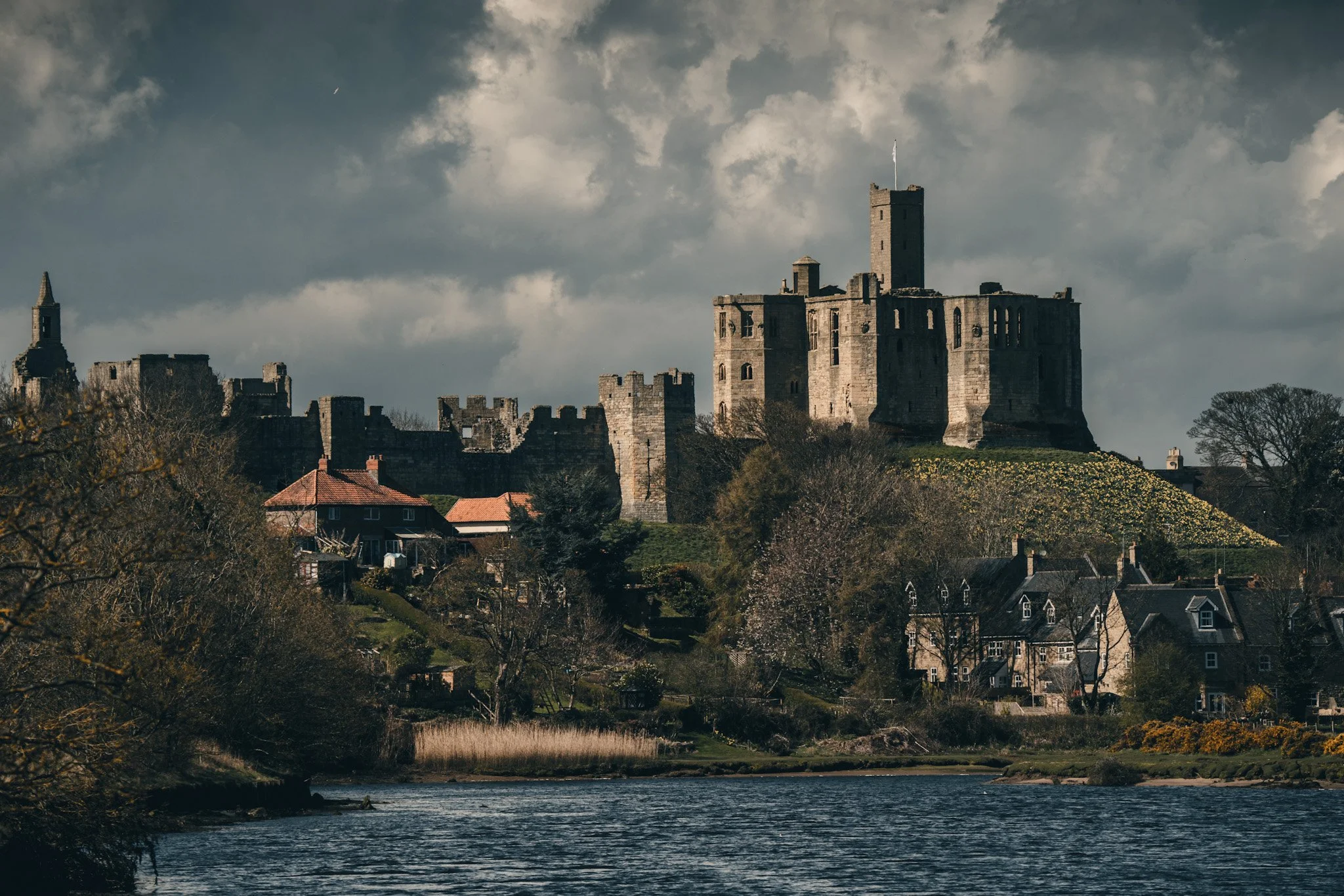
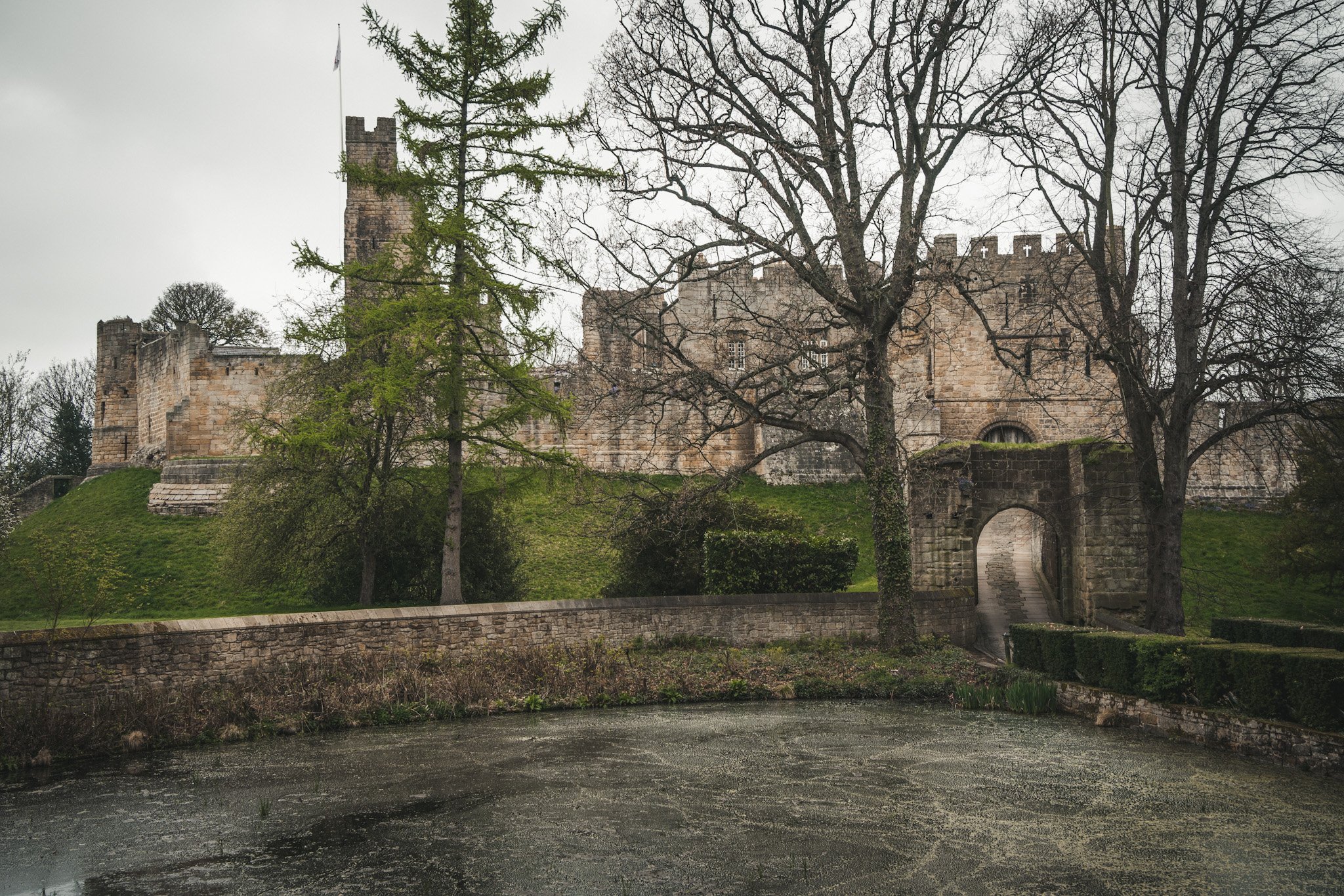
Warkworth
Although the settlement of Warkworth in Northumberland dates back to at least the 8th century, the first castle was not built until after the Norman Conquest. The timber castle was considered "feeble", and was left undefended when the Scots invaded in 1173.
The town and its castle occupied a loop of the River Coquet. The castle was built at the south end of the town, guarding the narrow neck of the loop. A fortified bridge also defended the approach to the town. The surrounding lowland countryside was favourable for agriculture.
When the existing castle was constructed is uncertain: traditionally its style has been ascribed to Prince Henry of Scotland, Earl of Northumbria, in the mid-12th century, but it may have been built by King Henry II of England when he took control of England's northern counties. Warkworth Castle was first documented in a charter of 1157–1164 when Henry II granted it to Roger Fitzrovia’s Richard.
The gatehouse in the centre of the south curtain wall mostly dates from the 13th century. It was originally accessed via a drawbridge and visitors had to pass through two gates, one at either end of the passage, and a portcullis.
Widdrington
The medieval tower house is documented in 1341 when licence to crenellate was granted to Gerard Widdrington. By 1592 the castle consisted of three parts: the original (south) tower, a great hall to the north, and beyond that the north tower. Both towers projected eastwards from the hall leaving a recess containing the principal entrance.
At ground level, the rise is visible as a roughly circular mound 6ft high and 160ft in diameter.
Between 1592 and the Civil War (1645-49) the hall was rebuilt and heightened. Between 1653 and 1676 projecting wings were added to the north and south from the two towers by William, Second Baron Widdrington. He also laid out an enclosed forecourt and, to the south of this, a walled garden. In 1720 the castle was bought by York Buildings Company and was described as in a very ruinous condition and in danger of falling.
Some time after 1772 the castle was demolished by Sir George Warren and then rebuilt, based on a drawing by S and N Buck made in 1728. This new structure burnt down before it was completed and was replaced, on a new site to the south east, by a Georgian Gothic castle designed by Thomas Sewell of Alnwic
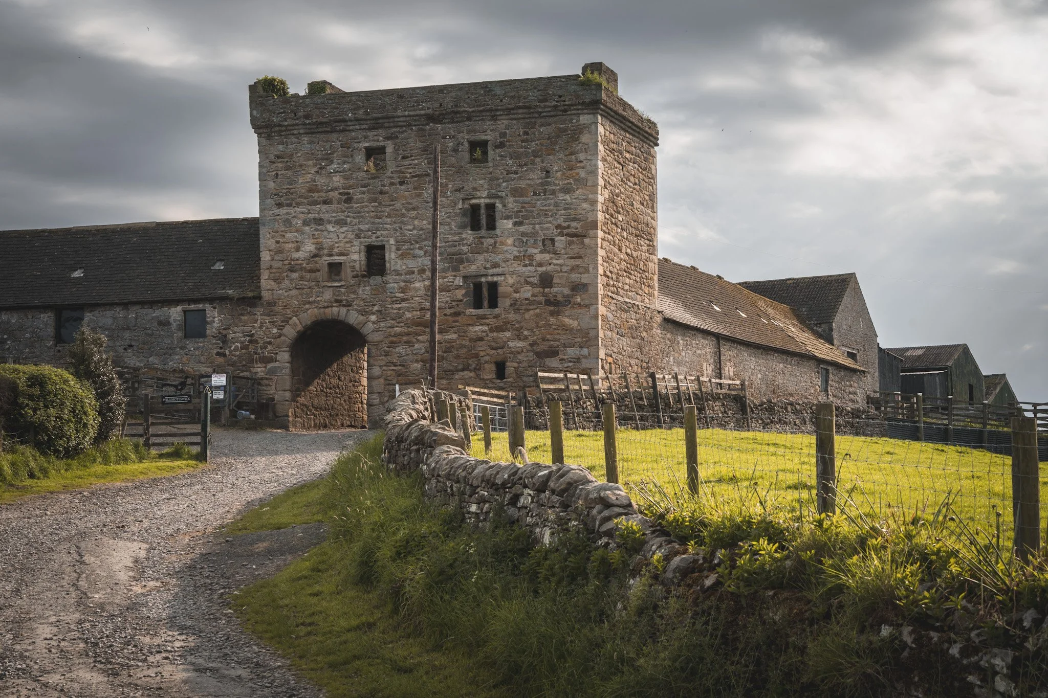
Willimoteswick Castle
A 16th century castle incorporating building remains from the 12th century and largely rebuilt c.1900. The gatehouse, is still well preserved and the barmkin, now a farmyard in which stands the old farmhouse with turrets at either end.
Air photographs have shown a number of earthwork features to the south and east of the castle, including the foundations of possible buildings and other structures, a trackway, boundaries and ridge.
Not recorded in the 1415 survey, in the 1541 survey recorded as “At Willymonteswyke ys a good toure & stone house joyninge there unto of the Inherytence of Nycolas Rydley kepte in good.”
Willimoteswick is traditionally the birthplace of Bishop Ridley who with Latimer was burnt at the stake in Oxford in 1555.
The roof of the gatehouse must have disappeared before the middle of the 19th century because the first edition Ordnance Survey map clearly marks the line of a wall inserted in the ground floor to make a forge.
The farm is occupied today by the sixth generation of the Storrow family.

Wooler (Green) Castle
The monument includes the remains of a ringwork of medieval date, known as Green Castle, situated on a high promontory above the Humbleton Burn and overlooking the town of Wooler.
This example if D-shaped in plan, and measures approximately 150 feet across internally. It would have been mainly of timber construction and was in use until the beginning of the 12th century, when it is thought the castle and its occupants were moved to the town nearby.

WOoler Castle
The remains of a medieval tower house of early 16th century date situated on a prominent mound. The tower survives as three large blocks of masonry, one of which, a mass of core material, is believed to lie in situ.
A block lying near a modern war memorial is a section of the corner of the tower with walls 1.5 metres thick; the walling is faced with large blocks of sandstone. To the east of these remains are traces of a slight earthwork platform.
The mound on which these fragments lie is believed to be natural, rather than artificial, but is the probable site of a 12th century castle with timber defences which belonged to the Muschamps.